Uncategorized

Skjálfandi Bay – rivers and whale watching

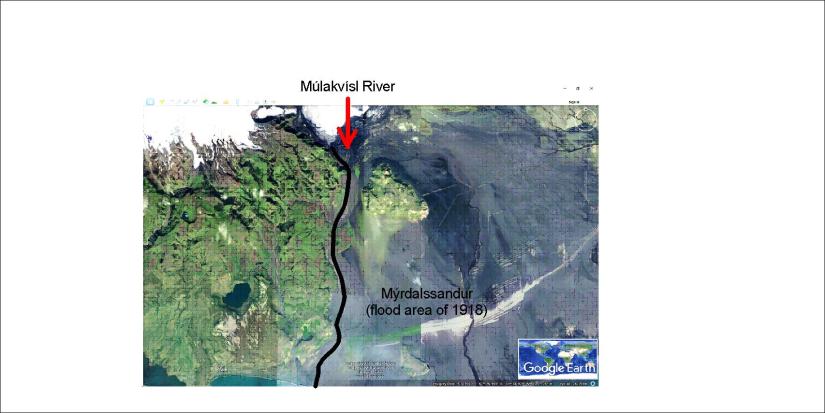
The Skjálfandi Bay is the most famous whale watching area in Iceland. Two rivers flow into the bay, providing nutrients for the whales. The tectonic framework is typical for the north of Iceland, a dominant NS-framework.

Skjalfandi

The framework is so obvious that there is no need exaggerating features by drawing the relevant lines on the Google map. The arrangement is clear. Note the feature aligned SE-NW in the upper corner to the right. This is the fault at Húsavík, an important part of the division of the tectonic plates of N-America and Eurasia.

The basic settings can be explained on a map base from the organization of Náttúrufræðistofnun:

Skjálfandi Bay and Tjörnes Fracture Zone

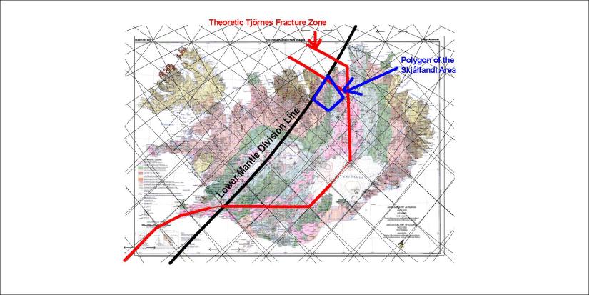
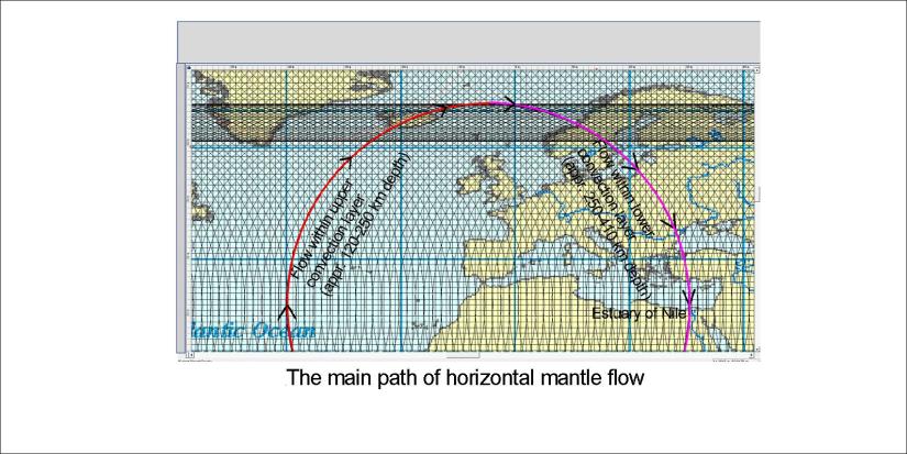
The area from the Google map is found within the blue polygon. The symmetry within the mantle is reflected by symmetry on the surface. The main Lower Mantle Division Line does cross the Tectonic Plate Division Line within the Skjálfandi Bay just outside the town of Húsavík. The division line is double or even triple, so another crossing is found in the Öxarfjörður Bay. Together these lines form the Tjörnes Fracture Zone.

the name Skjálfandi Bay can be translated as Tremble Bay or Earthquake Bay, because it is located within the fracture zone where earthquakes are quite common.

To be more precise, we can add the exact calculation for the Húsavík Fault:

Húsavík fault


Uncategorized

Múlakvísl – The World’s largest river in 1918?

When the volcano Katla erupted in 1918, a huge flood occurred in South Iceland. A smaller flood actually washed away the bridge of the river Múlakvísl in 2011 in the same area. It was expected that Katla would erupt after Eyjafjallajökull, because that sequence of events was also found in 1612 and 1823.

Occasionally, these floods become so big that the discharge exceeds the Amazon river. Therefore we say jokingly that the biggest river of the World is in Iceland.

The plain where the flood happens is called Mýrdalssandur, and the rivers Múlakvísl and Blautakvísl flow through the area. So for the eruption of Katla that started almost 100 years ago, the flood area is shown here on the Google map:

Múlakvísl

As for the tectonics of the area, a combination of SE-NW features of mantle alignment and NS topography leading the flow of rivers can be detected.

Uncategorized

The beauty of Mediterranean forms

The forces creating the opening of Gibraltar have also closed it. The Mediterranean is subject to large tectonic force in between the continents of Africa and Europe. Eventually the Strait of Gibraltar might close again and the Mediterranean would more and less dry up. These large forces create beauty with regular forms as can be found here:

Mediterrranean

The mathematics behind this are amazing. Note the diagonal tectonic feature from SW to NE, crossing the center of the WE-axis extending from the middle of Gibraltar Strait. And the two semicircles make the coastlines holistic and absolutely symmetric.

So should we try to explain this? The same story repeats itself very often, namely WE-alignement can be found at many locations. Tension like the pressure between Africa and Europe can then lead to elliptical forms or even circular. Many others have noted the shape of the surroundings of Gibraltar, suggesting for instance that this is due to meteor impact. Here it is suggested that the the interplay between symmetric convection rolls, aligned almost NS through Gibraltar, and the horizontal tectonic forces are responsible for this obvious regularity.

The Nile flows directly from south to north into the Mediterranean, and the Atlantic Ocean flows directly through this opening from west to east. Gradually we realize how the combination of Earth’s rotation and mantle convection shapes our surroundings.

Uncategorized

The Nile – World’s longest river flows northwards

The Nile flows northwards. The Egyptians and the Greeks noted this with curiousity. Eratosthenes made use of that fact to measure the circumference of the Earth more than 2000 years ago. We can still learn something from this mighty river. It is originated at equator and flows directly northwards (as accurately as possible for a river) towards the Mediterranean at 30°N. Let us have a look at Google map:

Nile - NS

Why on Earth did Nile choose this path? Actually, it can be explained. Rotation of the Earth actually directs it directly northwards, but the mechanism involved can only be understood in context with the convection rolls of the mantle. The symmetry of polygons creates a tectonic path aligned NS. The special condition along equator of weather and tectonics combined create the origins. The estuary is also at a special point, but that has to be explained separately with a map:

Nile - convection rolls horizontal circle

The two layers of convection rolls between 120-410 km depth form a holistic circular path (mathematically according to horizontal cylindrical projection). The path shown also represents the division line of the large cells of lower mantle. The backflow (strongest mantle backflow line) is found to pass the estuary of the Nile.

This can be compared with the estuary of Amazon river, found exactly at the division point of large cells along equator.

Uncategorized

Special conditions – NS alignment of convection cells at 32°N and 32°S

The convection rolls shall be oriented exactly NS at 32°N and 32°S. Is there any indication for this? Let us have a quick look. What about these two locations:

S-America NS at 32S

This surely can not be closer to NS.

Japan NS at 32N

Neither can this.

This means we can find very prominent features at 32°N and 32°S aligned NS, the same way as the convection rolls underneath.

Can we find something more special at the 32nd latitudes?