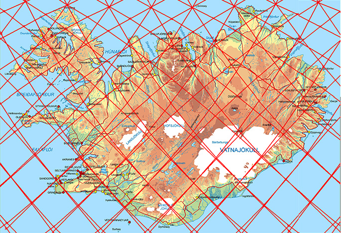
This grid can be used for reference, explaining tectonic features of Iceland.
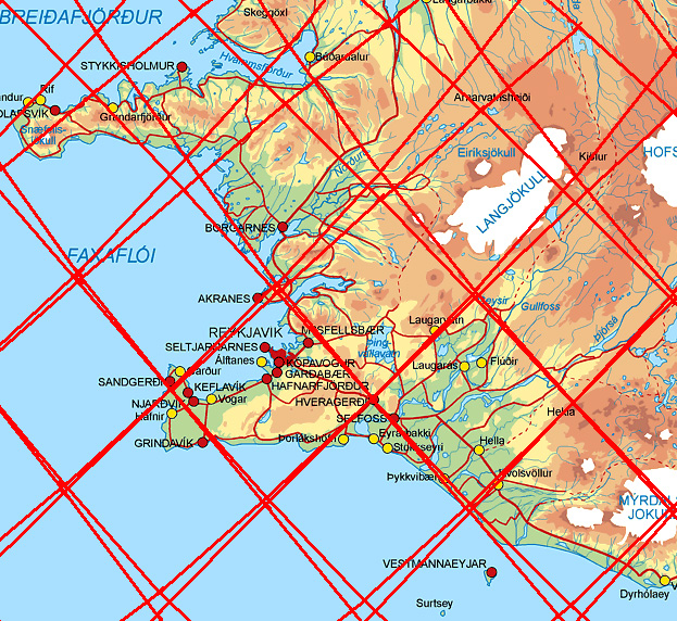
Having a closer look at Reykjanes Peninsula:
Reykjanes Peninsula and the SW part of Iceland
The Icelandic Met Office
The division lines of layer 2 and 4 between 120-410 km below the surface cross the earhquake swarm from SE to NW. A volcanic system and a seismic zone are also found within the area.
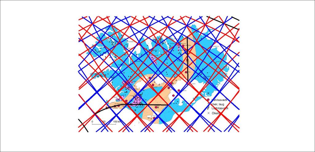
Comparing the convection rolls with the distribution of geothermal heat, a correlation is found. 1. Between division lines and high temperature areas. 2. Between tectonic plate division line and high temperature areas. 3. Between polygons and low temperature areas.
Map from Náttúrufræðistofnun Íslands showing geothermal areas
The consistency is quite obvious, but also it can be pointed out how Kverkfjöll, Askja and Fremrinámar occupy each one polygon. Geysir in Haukadalur, Hveravellir and Kerlingafjöll are found above mantle rolls division lines.
As for low temperature, the concentration within certain polygons is a special study.
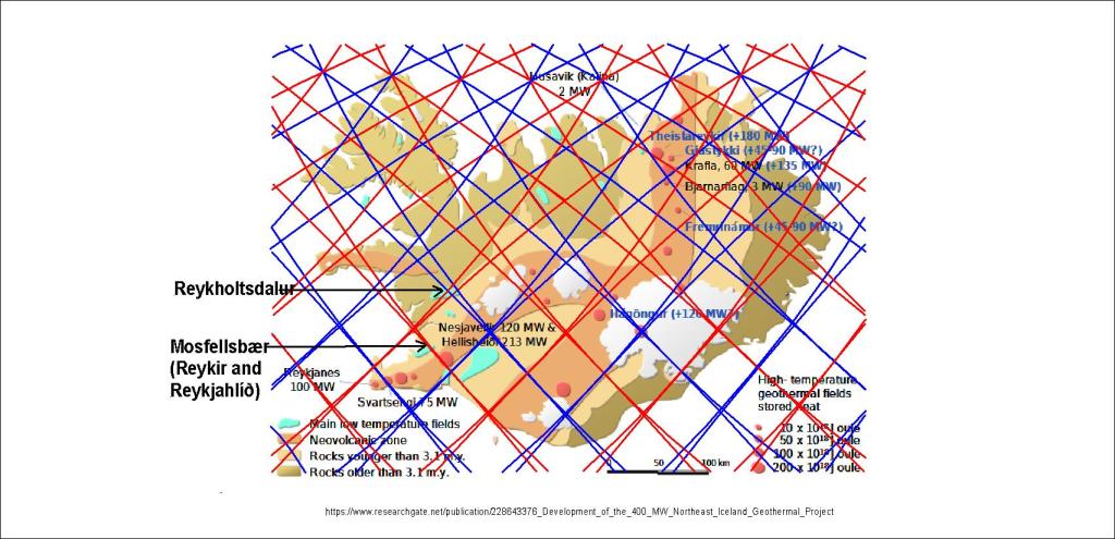
The correlation is even clearer on this map from the wikipedia page about geothermal heat in Iceland:
Correlation between convection rolls and geothermal areas.
The outer border shape of low temperature areas follows the polygons. The five main areas shown here are for the Southern Lowlands, Reykholtsdalur, Skagafjördur Eyjafjördur and Skjálfandi, all show this trend.
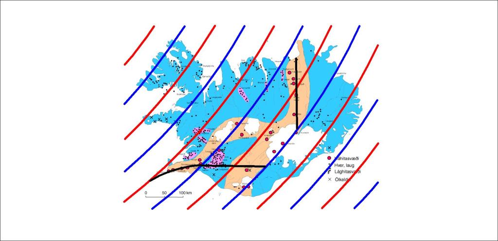
The easiest way is to concentrate on the uppermost layer, found below the tectonic plate at 120 km depth. Then the division lines between the convection rolls are shown more clearly.
Only the uppermost layer of convection rolls shown, red for upwelling, blue for downwelling, along with division between tectonic plates with a black line.
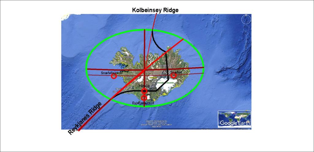
Extending the Reykjanes Ridge, a symmetric picture of Iceland emerges. This is consistent with the presumption that the two convection rolls shaping the Reykjanes Ridge extend under Iceland in the way as drawn with red line across Iceland from SW to NE.
The symmetry around the Reykjanes Ridge extended line (red).
The Icelandic platform forms an ellipse around the extension, aligned E-W. The two volcanoes of Hekla and Eyjafjallajökull are on the NS axis of the ellipse. The two outposts of Icelandic volcanoes, Snæfellsjökull and Snæfell, are equadistant from the NS axis, and located exactly on the same latitude. If the Kolbeinsey Ridge is also extended, it is found reaching the same central point, merging with the NS axis of the ellipse and the volcanoes Hekla and Eyjafjallajökull. This high degree of consistency is in conformity with the analysis of the convection rolls below Iceland.
We know why geothermal heat is found in the area of Reykir near Mosfellsbær, providing Reykjavik with about half of the geothermal energy needed to heat the city. It is explained for instance in an article by Daníel Einarsson (3D modelling of the Reykir geothermal areas in Mosfellssveit, Iceland).
The map generated by Daníel Einarsson, showing the geothermal areas in Mosfellssveit
This shows clearly the NW-SE alignment of the area, even though it is associated with a fissure swarm oriented NE-SW. Therefore a comparison with the mantle convection rolls alignment is needed to see the reason for this topography and arrangement of geothermal resources within the area.
The NW-SE oriented convectin rolls division lines near Mosfellsbær
The alignment is found to be the same as of the calculated NW-SE lines. Therefore it can be reasoned that the geothermal activity is associated with three factors. First an old high temperature area that has cooled down, second the fissure swarm from Krýsuvík and Trölladyngja, and thirdly from the effect of the edge of the relevant polygon, whereas two division lines of convection rolls are found underneath the geothermal fields.
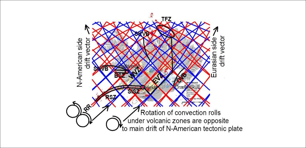
The convection rolls underneath Iceland shape the volcanic and earthquake zones. A line can be drawn between the tectonic plates, and then the interaction between teconic drift and convection rolls can be derived. Here the main zones have been marked on the map:
Here the relationship is shown between Reykjanes Ridge, Reykjanes Seismic Zone, South Iceland Seismic Zone, East Volcanic Zone, North Volcanic Zone, Borgarfjörður Seismic Zone, West Volcanic Zone, Snæfellsnes Volcanic Belt, Skagafjörður-Hofsjökull Volcanic Belt, Öræfajökull Volcanic Belt and Tjörnes Fracture Zone.
Without this grid, the reasons for the location of all those volcanic zones and earthquake zones become obscure. The similarity between the position of SISZ with Hekla and BSZ with Hallarmúli is pointed out specially. Hekla and Öræfajökull appear at the same kind of crossings, 3° apart on the same latitude. The difference between the mountains can be explained, as Hekla is at the edge of a rift zone, whereas Öræfajökull is not. Tjörnes Fracture Zone is aligned along the convection division lines. The South Iceland Seismic Zone polygon is found both south and north of the division line of the tectonic plates. The southern end drifts eastwards, while the northern end drift has a component to the west. Therefore it breaks in the middle in a way known as the bookshelf pattern.