Uncategorized

The Pattern of Large Fjords in North Iceland

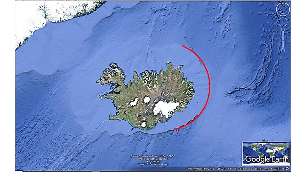
The fjords in North Iceland are rather large and wide. They look at first as randomly distributed with various shape. Comparing with the convection currents underneath, the pattern is not random at all. The convection rolls division line extending from the Reykjanes Ridge marks the three eastern fjords of Eyjafjörður, Skjálfandi and Öxarfjörður. The crossings between that line and the other equator lines of the next layer below mark the estuary of the relevant rivers flowing into the fjords. The next division line north of the Reykjanes Ridge line works in the same way, marking Hrútafjörður, Húnafjörður and Skagafjörður. The result is a ladder-shaped pattern for the fjords, when compared with the mantle convection rolls underneath.

The pattern of large fjords in North Iceland

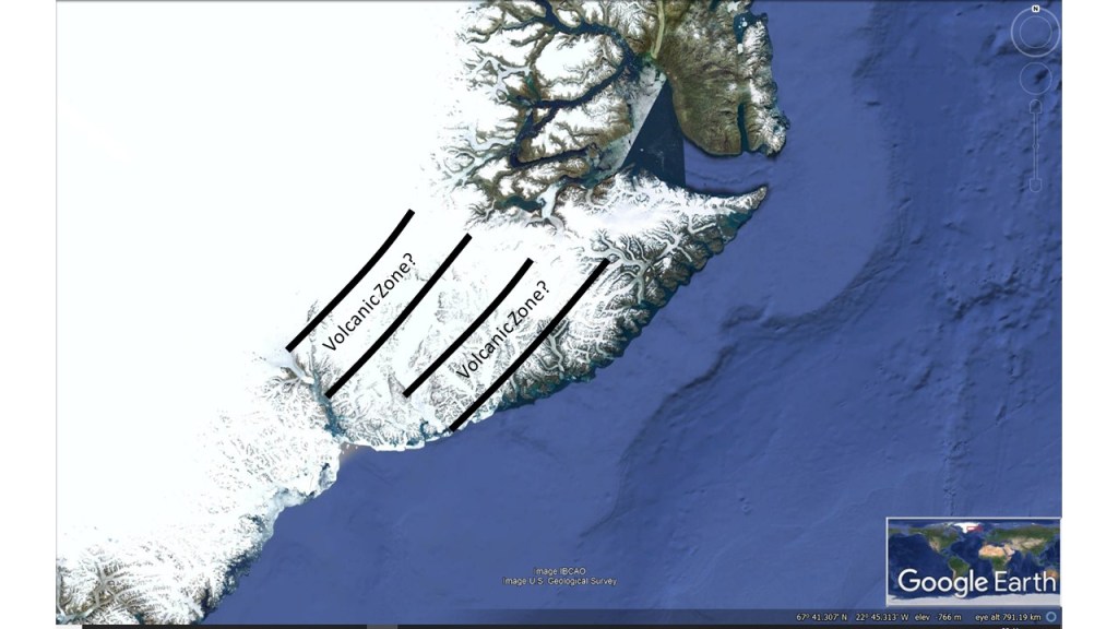
The two layers forming the surface in this way (with help from the glaciers above during the ice age) are actuallly the subducted convection rolls, at this latitude only found close to 410 km depth. How can the upper rolls be a secondary factor? Actually they also have their say. The lower set of convetion rolls at the north coast seem to have a certain degree of coupling, and therefore the Tjörnes Fracture Zone mainly follows the division lines of those lower layers. In the same way, the lower layers have this effect on large scale formation of topography of the North of Iceland.

Uncategorized

Hudson Bay Arc and the Icelandic Shelf Limit

One of the geological mysteries noticed is the Hudson Bay Arc. It is quite perfectly shaped, but the reason is not known. The edge of the Icelandic shelf platform is also an arc, but under the surface of the ocean, so it is less noticed on maps.

The Hudson Bay Arc
Iceland Shelf Arc

As can be seen on the maps, the arcs are identical. It does not necessarily mean that the two topographical / bathymetrical features are originally formed in the same way.

I have already examined the Icelandic Arc in detail in other posts. The Hudson Bay Arc is much more difficult to study, but this might be a clue for others to investigate further. https://magicmagma.com/2020/03/04/the-symmetry-of-iceland-around-the-reykjanes-ridge/

See also: https://www.mentalfloss.com/article/609355/geological-formations-baffle-scientists

Uncategorized

Equatorial Plane of Earth – Convection Rolls Pattern

Knowing the different layers of Earth, we can find out the pattern of convection currents within them. It is obvious within the equatorial plane, because the most regular pattern possible fits exactly into it. Outside the equatorial plane, both centrifugal force and convection paths have to be considered separately. Accordingly, the whole system of convection rolls within the mantle could be analyzed. Knowing the position of convection rolls all over the planet, all the comparison found within this site could be made.

Model of the equatorial plane of convection currents

The core of the earth is extremely hot, constantly being heated by radiation. The radioactive material is mainly found within the upper layers, but the mantle must let the heat radiation through all the way down to the core, thereby heating it. The heat is then transferred from core to the bottom of the tectonic plates by convection currents. That is how the Earth works.

Uncategorized

Largest Lava Flows on Earth during Holocene

Three largest lava flows on Earth during the Holocene period are all originated from a single area in Iceland. First is Thjorsárhraun Lava Field (8,000 years ago), from the Bardarbunga Volcanic System. The magma did flow underground to the Veidivotn area, where the eruption took place. The second was the Eldgjá Lava Field. Then the magma originated from the Katla Volcanic System, forming about 60 km long row of craters. Now it has been found that the eruption took place in 938. Third is the Eldhraun Lava Field from 1783-84. The magma created a dyke from Grímsvötn Volcanic System over to Laki, and then the rift developed to the SW and NE from there.

Eldhraun Lava Field from the Skaftáreldar Eruption 1783-84.

All the eruptions seemingly started near a major upwelling division line of mantle convection rolls. The same division line takes part in forming the central area of Hveravellir.

Origin of three larges lava flows on Earth during Holocene period.
The arrows show flow (dyke formation) from caldera area towards eruption sites.

The polygons, where the dykes and craters form, are subject to direct pulling effect from the large scale tectonic drift of the North American Tectonic Plate. Rifts open up perpendicularly to the drift direction, forming dykes and craters due to volcanic activity.

This indicates that the upwelling line encountered by the large scale dyke formation, somehow ´ignites´ the approaching magma, leading to eruption.

Uncategorized

Were there Volcanic Zones in Greenland?

The Tertiary volcanic formations in Greenland south of Scoresbysund are quite similar to Iceland. Therefore there might be found some similarities. The first to look after are traces of volcanic zones. They might look like this:

Were there volcanic zones in Greenland?

This is only based on the presumption that this peninsula was formed under similar circumstances as Iceland.

Some research has been made on the topic: https://jgs.lyellcollection.org/content/154/3/565 , indicating that activity was developing in a rift zone close to the coast, which would then resemble the Icelandic East Volcanic Zone, or even also Öræfajökull Volcanic Belt, replacing the activity of Western Volcanic Zone.