There are 7 volcanic zones and 30 volcanic systems in Iceland. Besides that, geothermal heat can be found in all parts of the country. Here I am dealing with all that and much more. The history of its geology and the understanding of the processes active today become so much clearer once the arrangement of the convection cells under the country is known.
Blog
Öræfajökull – strange position?
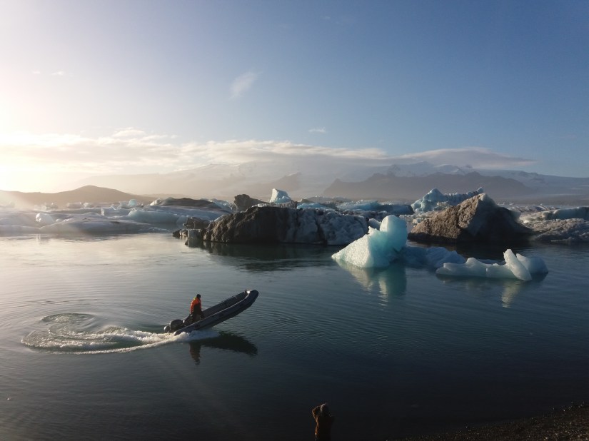
Jökulsárlón (Glacier Lagoon) with Öræfajökull in the background.
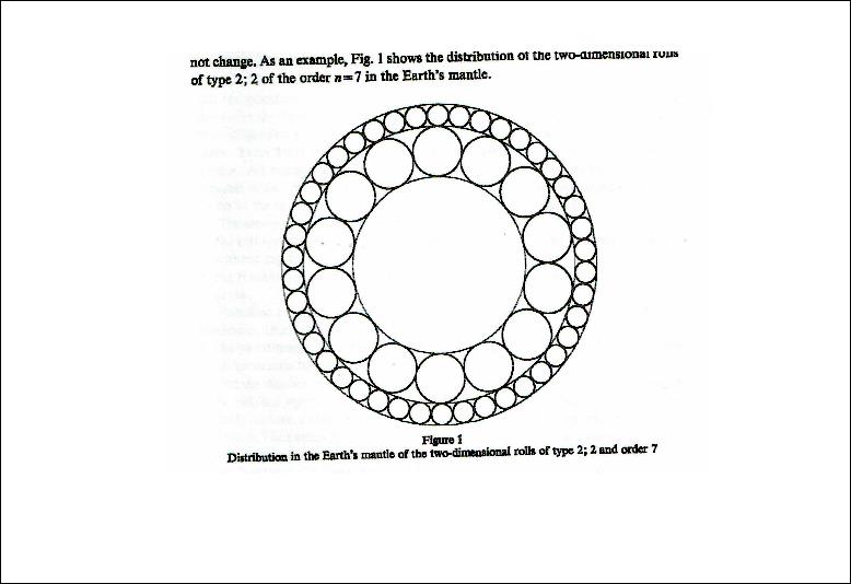
The position of Öræfajökull fits exactly to the arrangement of convection cells under Iceland. Recently, quite many earthquakes were measured below the SW part of the mountain. At the 64th parallel all the four layers are equally thick. It is the latitude where the convective layers from north and south meet and arrange themselves in a regular pattern. You can see a drawing showing this at the front page of this website. Accordingly, the flow of magma is probably originated about 120 km below the surface, first flowing through the ductile part of the tectonic plate and then making its way with help from the constant work of the other three layers on the same point up through the brittle part of the crust.
This is of course not easy to understand at first, but along the 64th latitude both Hekla and Öræfajökull are over crossings of these four convective layers.
As this convection cell system can be put into a mathematical form according to some very simple preconditions, we can understand why Öræfajökull has this location on the 64th parallel. Is that enough for us?

Tectonic drift
Morgunblaðið published this map in June 11th 2004. The title can be translated: The land is still widening and moves northwards. The same map was then published in a booklet – ISNET2004 – by Landmælingar Íslands (National Land Survey of Iceland). On page 37 it is repeated that Iceland drifts to the north.

To clarify this further: Iceland drifts closer to the North Pole, away from equator.
The results presented with ISNET2004 fit accurately with the convection cell system extending from the North Pole over Iceland, as shown here:

Note the symmetry and how exactly the vectors fit with the calculated lines in the East and West of Iceland.
Background of this work
In 1962 Harry Hess made a big contribution by showing the importance of mid ocean ridges in Earth’s geology. At the same time he put forward his idea about convection current system:
Hess, Harry. „History of Ocean Basins.“ Petrologic studies: a volume in honor of A. F. Buddington Geological Society of America (1962): 599-620.

This picture drawn by Harry Hess, if taken accurately, gives 8 large convection cells around the globe.
In 1971 Uwe Walzer wrote an article showing that convection cells within the earth must be as regular as possible. He explained the preconditions for for this conclusion and searched systematically for a solution.
WALZER, UWE. 1971. Pure and Applied Geophysics Volume 87, Number 1, 73-92, DOI: 10.1007/BF00878910
This drawing by Waltzer has 14 large mantle currents.
With additional information available since the times around 1960-1970, I found the large convection cells to be 12, not 8 or 14! And with the help of a few laws of physics, geology of Iceland suddenly seems so much more simple to understand!
The logo of this site shows the slightly different pattern:
![]()
With the 240 smaller cells side by side under the crust and by referring to the Coriolis Effect (different angular velocity for each latitude), the 3D model was completed.
It can be used right away to answer a million questions!
Beerenberg in Jan Mayen
Beerenberg in Jan Mayen is in the line of the Eastern Volcanic Zone of Iceland! It has to be calculated with the formula for the polar system of convection cells. It looks like that:

Looks complex? It is not, because you do not need the formula to see how the famous Laki is in the same line as Beerenberg. The same convection cells are at work underneath both volcanic sites! The location of the volcanic sites can be explained by referring to the convection rolls of the mantle.
