Blog

Uncategorized

The layers under Iceland

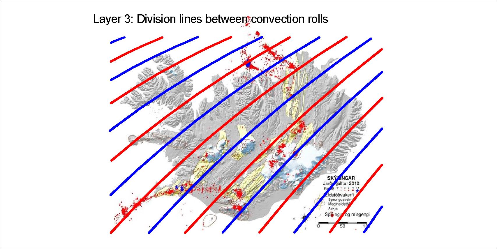
The layers between 120 and 410 km depth affect the tectonics of Iceland. Within the division lines between the rolls, Munroe effect sends magma up into the tectonic plate, marking polygons at the surface. The four sets of division lines of the four layers are drawn here, red for upwelling and blue for downwelling.

The upper most layer extends NE to the pole
Layer 2 extends NW towards the pole
Layer 3 extends SW to equator
Layer 4 extends SE to equator

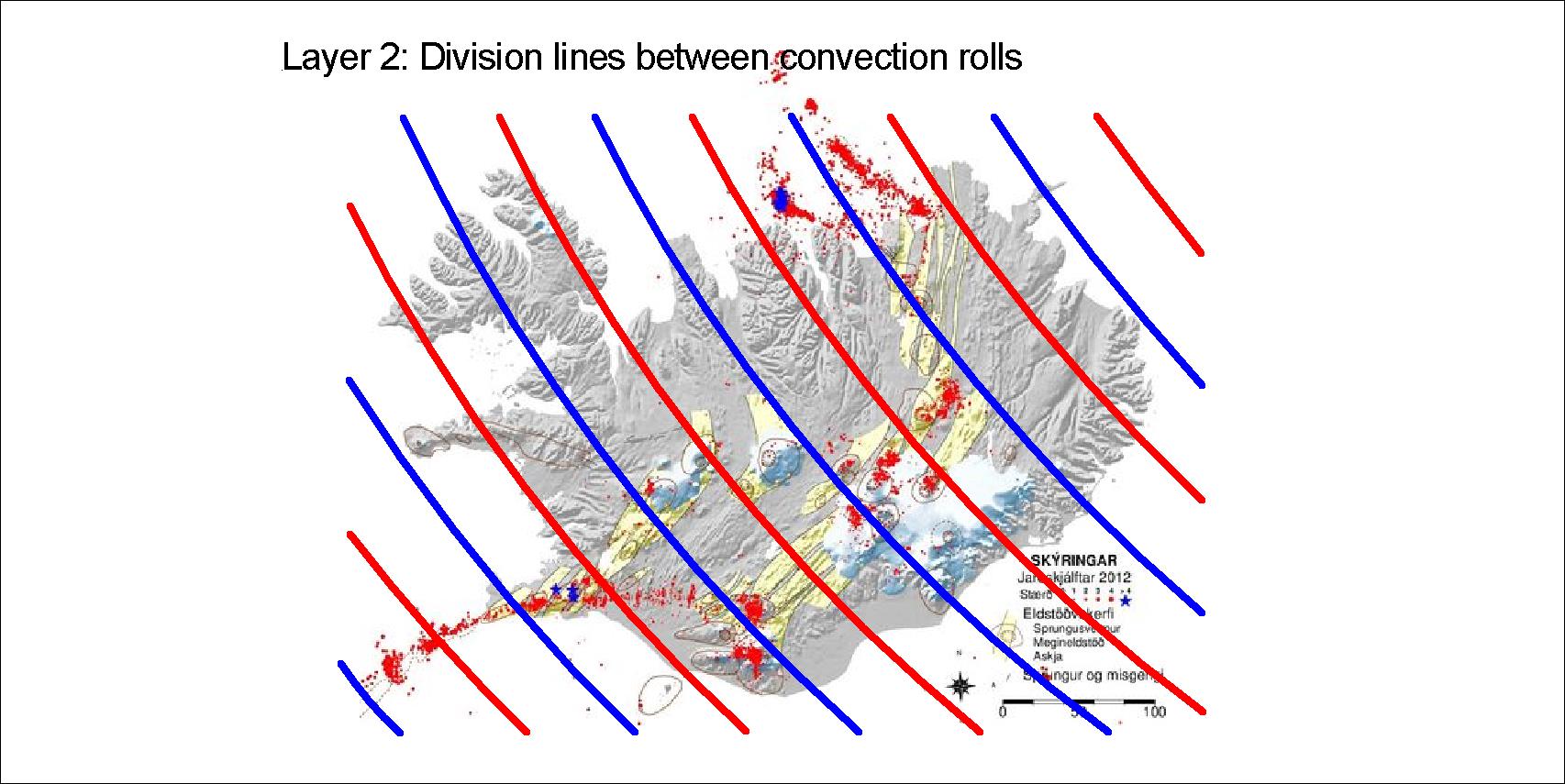
The situation in Iceland is exceptional, as south of 60.7°N there are only two layers within the range of 120-410 km.

The four layers explained, layer 1 at the top and layer 4 at the bottom. Below layer 4, ther large convection cells of the lower mantle extend down to the Gutenberg layer

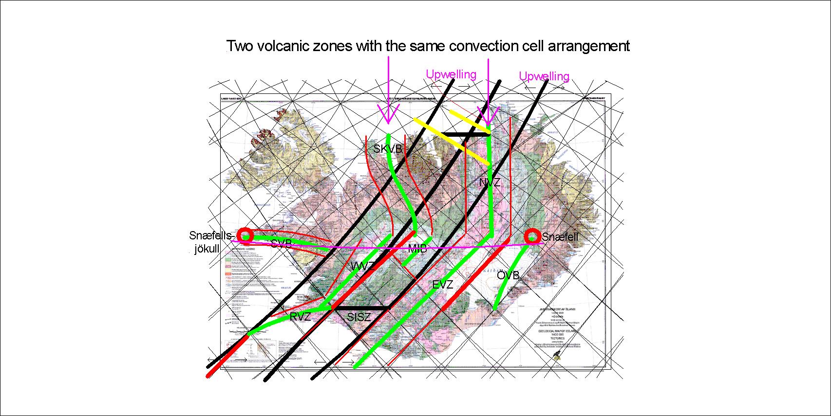
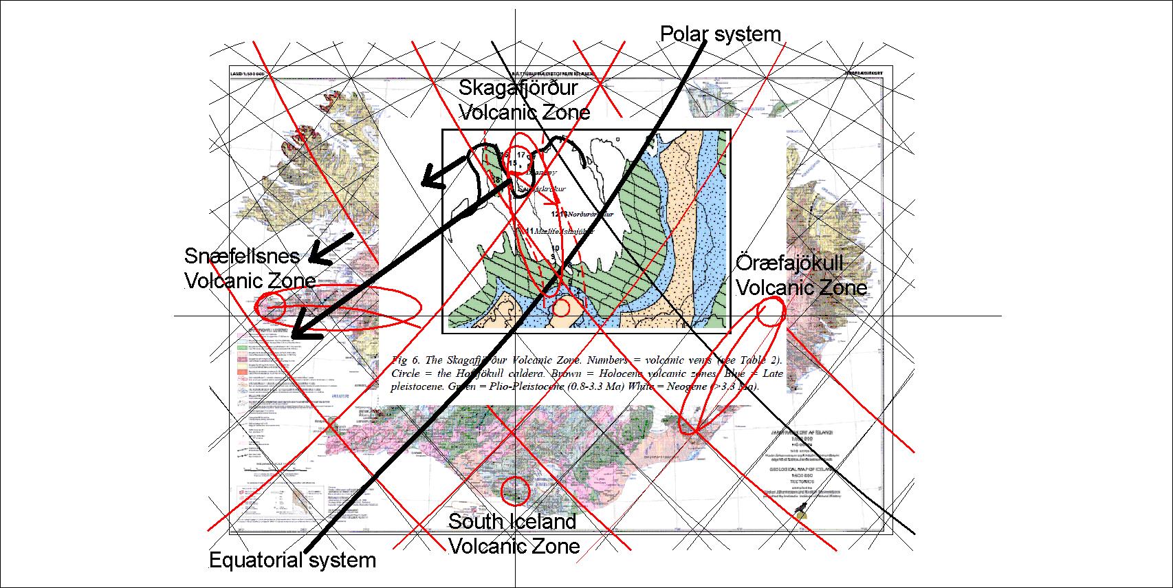
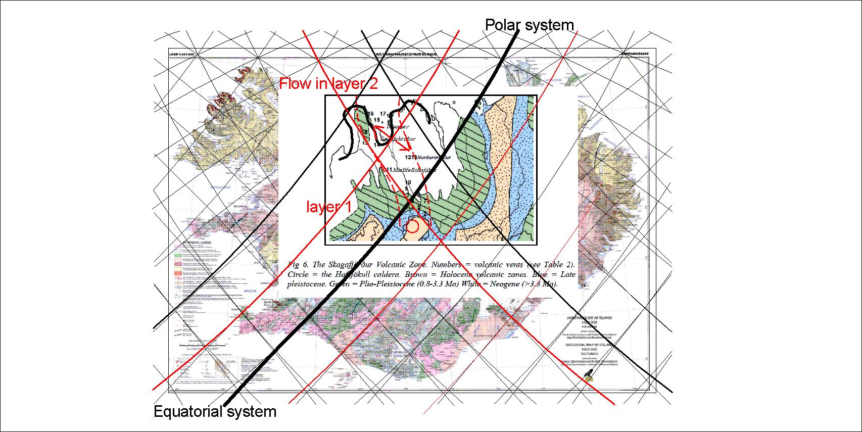
These four layers have to be looked at in context with the large convection rolls of lower mantle. The tectonics of Iceland can then be studied in detail by referring to the convection rolls system.

The four layers combined

By drawing all the lines on one map, the pattern ruling the formation of tectonics in iceland is shown.

Uncategorized

The pulling effect on volcanic zones

How do the volcanic zones really work? A tension between the large scale tectonic drift and local opposite mantle flow create a pulling effect on the area, so rifts and faults appear.

How the east volcanic zone of Iceland is formed

An upwelling line markes the western boundary of the east volcanic zone, and a downwelling line mars the eastern side. The flow under is from west to east, opposite to the drift of the tectonic plate. The local and global trends are opposite to each other.

The western volcanic zone is shaped in the same way. The eastern side is found along the next downwelling line, but the effect of pulling is only found in half the polygon. Snæfellsnes volcanic zone is also facing upwelling lines in the north. The Öræfajökull zone is facing the eastern trend of the tectonic drift, therefore having an upwelling line to the east.

Uncategorized

The two north volcanic zones of Iceland

Geologists focus on one volcanic zone of North Iceland, the one extending from Askja to Öxarfjörður. The Skagafjörður volcanic zone is still active, as earthquakes occasionally show, and Hofsjökull might be a part of it still active. Again, we can compare model and real circumstances:

Skagafjörður and Öxarfjörður are 3° apart, having same arrangement of convection rolls

The accurate consistency between model and surface features is one more reason that the convection rolls of the model are correctly calculated.

To learn about Skagafjörður volcanic zone, please read https://www.google.com/search?ei=XydrXKKQJcnawALJx6rwDA&q=%C3%A1rni+hjartarson+skagafj%C3%B6r%C3%B0ur&oq=%C3%A1rni+hjartarson+skagafj%C3%B6r%C3%B0ur&gs_l=psy-ab.3…4355.9971..11309…0.0..1.210.2360.16j6j1……0….1..gws-wiz…….33i21j33i160j0i22i30.HD99sOGAOXQ

Uncategorized

The four extra volcanic zones of Iceland

Besides the parallel volcanic zones, WVZ and EVZ, and the NVZ, there are four volcanic zones outside rift zones, one of the extinct.

The volcanic zones – the function of Skagafjörður and Snæfellsnes

This map shows the drift direction, due to effect of layer 2, leading to rifting in Skagafjörður for a period of about 1 million years. Note the volcanic sites on the NS and EW axis. The two volcanic zones of Skagafjörður and Snæfellsnes became active around the same period of time, as the same drift mechanism to the SW caused enough tension in the areas for volcanic zones to develop. The drift vector is of course totally different than people are used to see, as the convection rolls system has hitherto not been known. Once taking the different factors into account, it becomes possible to understand the details of the tectonic drift history of Iceland and elsewhere.

Uncategorized

The settings of the Skagafjörður Volcanic Zone

According to Árni Hjartarson https://orkustofnun.is/gogn/Greinar-starfsmanna/Arni-Hjartarson-2003-PhD/AH-04-Skagafjordur-Zone-an-ephemeral-Rift-Zone.pdf the Skagafjörður Volcanic Zone appeared 1.7 million years ago. It can be analysed according to the convection rolls:

Skagafjörður Volcanic Zone map by Árni Hjartarson inserted to a map base of Nátúrufræðistofnun. Convection Rolls Pattern for reference.

The Northern Reykjanes Ridge Rolls (with upwelling division line) excerts force to the east within the volcanic zone, pulling against the main tectonic drift to the west, thereby causing rifting within the area. The line below adds to the trend, marking the western front of the volcanic zone with a SE-NW alignment. During a million years the zone was active. Today the rift zone east of the main mantle division line (the wide black line) is responsibile for all the drift within that latitude.

The northern end is marked by the Skagafjörður polygon, wehreas the southern end is defined by the Hofsjökull polygon.