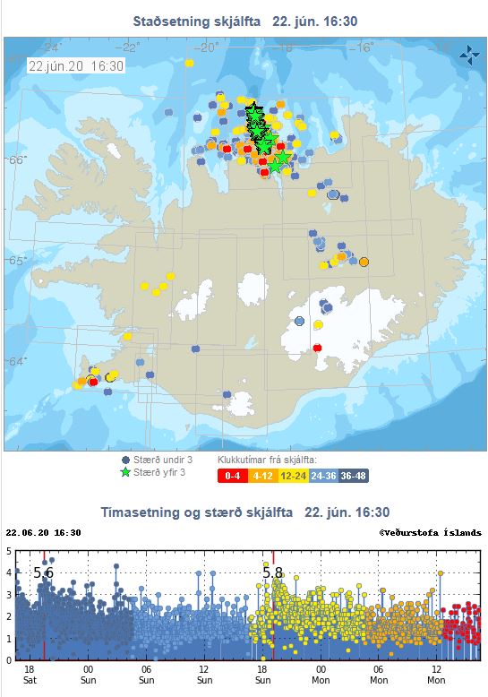
The Tjörnes Fracture Zone meets with the tectonic drift of the western side of the NS-axis of the North Volcanic Zone of Iceland, connecting it with the Kolbeinsey Ridge.
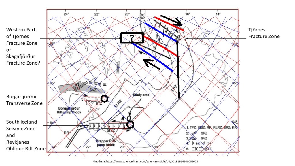
This shows how adjustments occur during tectonic drift due to the incosistency between the North Volcanic Zone and Kolbeinsey Ridge. West of KR, there is a weaker, but active part of the Tjörnes Fracture Zone. It covers the same convection roll span from east to west as the Borgarfjörður Transverse Zone. Reykjanes and SISZ cover the same convection rolls as the main part of Tjörnes Fracture Zone found east of the Kolbeinsey Ridge. https://www.sciencedirect.com/science/article/pii/S0191814106002653
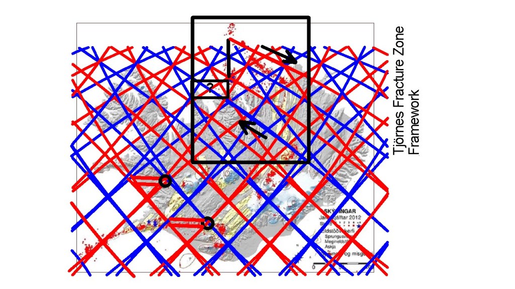
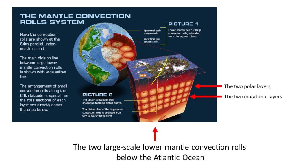
On this map, the function of shear pressure on the Tjörnes Fracture Zone Area can be seen. The earthquake epicenters follow the convection rolls division lines closely.