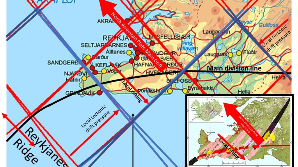
The Eastern Volcanic Rift Zone is unique and shows the interplay between tectonic drift and rift process. The rifting is perpendicular to the tectonic drift.
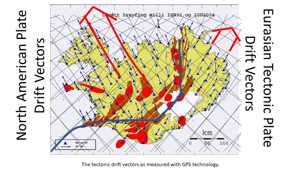
The drift in the western half is slightly faster than in the eastern half. The drift vectors tend to be perpendicular to equatorial convection rolls, and thereby the vectors are aligned along the polar convection rolls. Information about the measurements of tectonic drift is found here: https://www.lmi.is/static/files/utgefid_efni/Maelingar/isnet_endurmael_2016_skyrsla.pdf

This picture is found on a sign in the middle of the Eldhraun Lava Field which did flow in the year 1783.