Reykjanes Oblique Rift Zone is one of the most geologically complex areas in Iceland, because it has interwoven volcanic and seismic zone. The strike-slip faults of the seismic zone form due to pressure from SW and NE, whereas the volcanic fissures open when rifting occurs because of pulling from SE and NW. The polygon forming the main part of the Reykjanes Peninsula explains this. Therefore, we can see that different layers of convection rolls can affect the same area simultaneously.
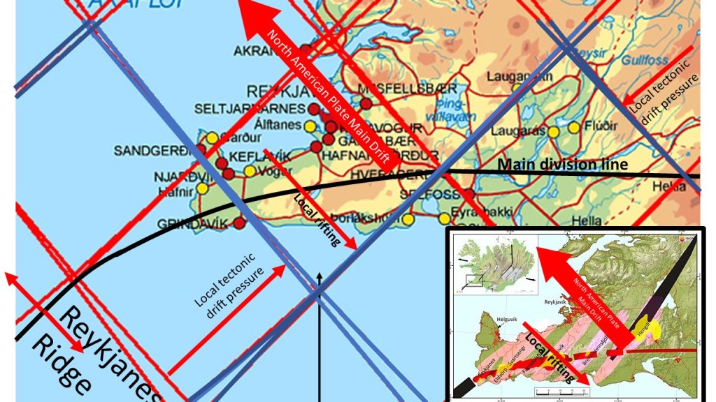
A map from ISOR has been inserted at the lower right corner to show how the volcanic zones form perpendicular to the drift of the North American Tectonic Plate on one hand, and the opposite small scale effect of the eastern Reykjanes Ridge Convection Roll on the other hand.
The local rifting due to effect of opposite magma flow of the convection current below is found on bothe sides of the division line between N-America and Eurasia, drawn as curved black line through the polygon of Reykjanes Peninsula.
Red lines indicate up-welling division between convection rolls, blue lines are for down-welling.
