Uncategorized

Iceland in 3D

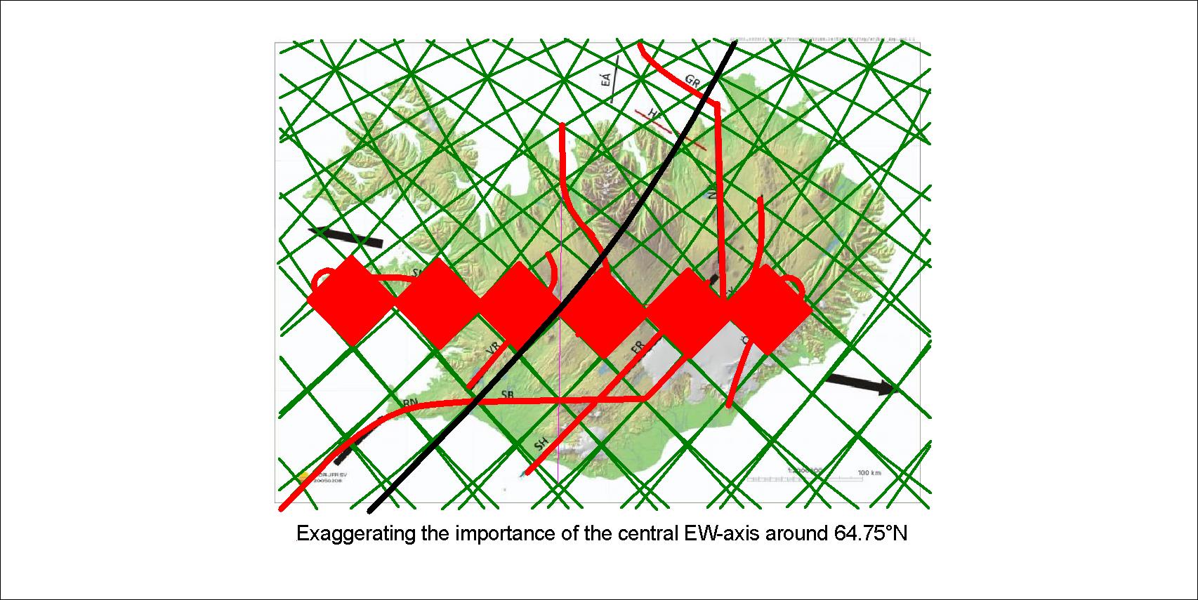
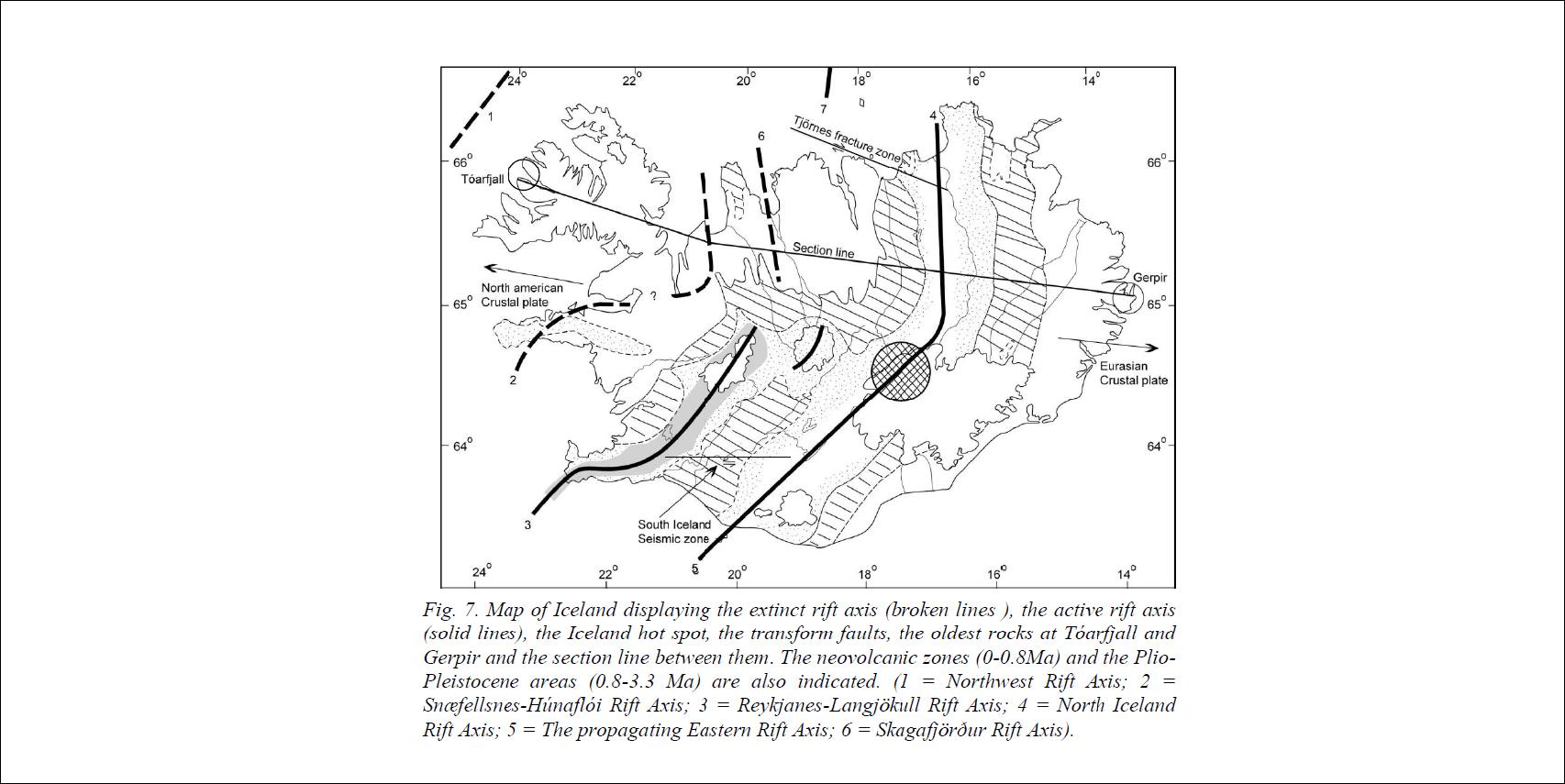
Looking at the foundations of Iceland at 64°N shows how the geology along the latitude is divided into distinct ‘chapters’.

Iceland with tectonic plate down to 120 km, then layers of convection rolls as they are organized along 64°N. The thickness within the intersection zone of individual layers is also shown.

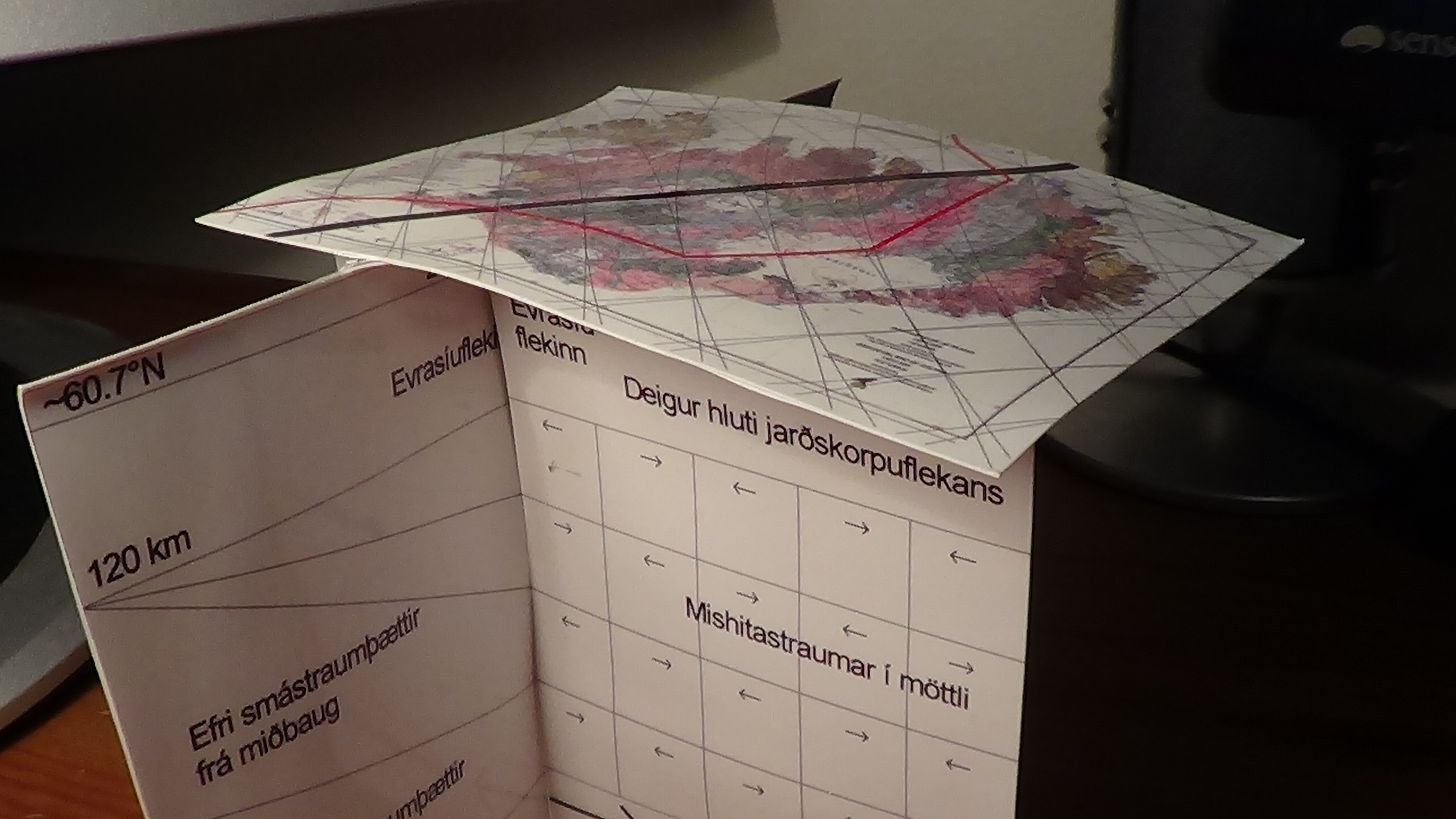
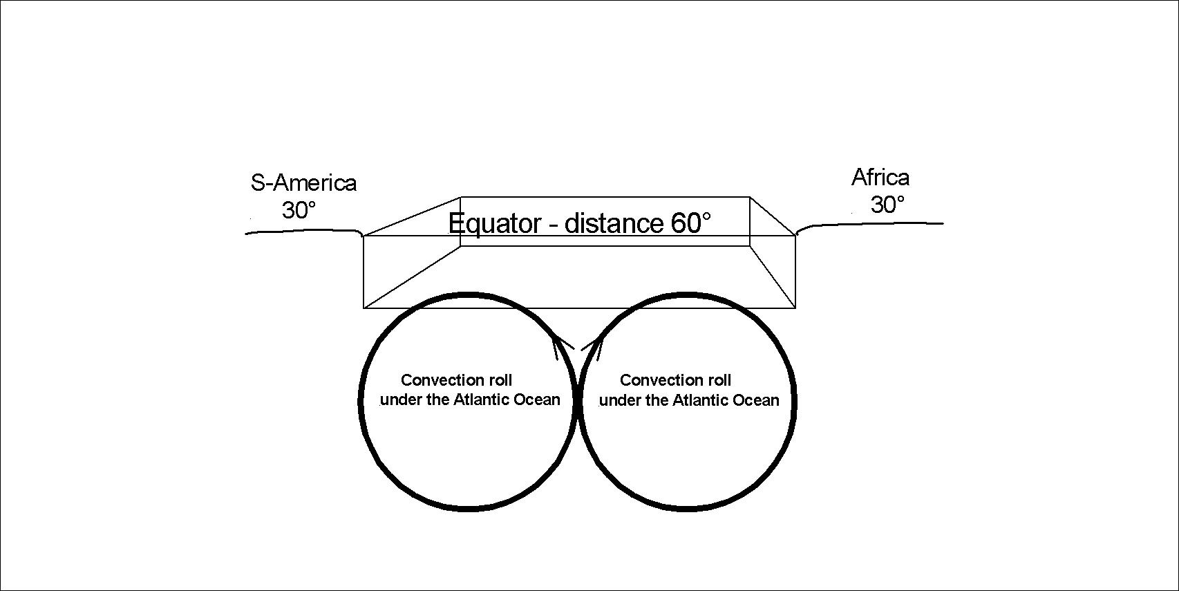
The convection roll shown farthest to the left is at the main division line over the large convection cells of lower mantle. It is marked with bold black line over the country from SW to NE. With 3D models like this one it becomes possible to understand the pattern of convection rolls under the tectonic plates all over the world.

Of course, this can still not be understood by looking at this model. The picture is published here just to show that the model has been derived, and everyone interested in the subject can learn about it. This has hitherto been a huge gap in the knowledge spectrum of geoscience.

Uncategorized

What is under the Atlantic Ocean

Under the Atlantic, a pair of convection currents has moved the continents to the East and West. The details of that pair of currents have been analyzed here, but for public introduction, first a simplified section along equator is presented:

The mantle convection currents under the Atlantic Ocean (not to scale)

The seafloor has some 3D effect, just to remind us that when we draw sections of geological features, it is to help us understanding the whole picture.

As pointed out on the drawing, upwelling takes place in the middle. Also, the distance between the continents at equator is exactly 60°, and a convection cell section spans exactly 30° from east to west.

Uncategorized

Central Iceland Parallel Zone Axis

One aspect of science and proof is repeated occurrence. This is found in Central Iceland where four axis of volcanic activity appear parallel to each other, each occupying one of identical polygons of the convection rolls system under the country:

Gosbelti rakin

By simply adding a red line on the lines of the original ISOR map, it can be seen how each volcanic zone occupies one polygon. One of them is the main rift zone, the ER-line. These polygons are all east of the Reykjanes Ridge. The Snæfellsnes Belt is found at a similar latitude, and is due to forces acting to a different direction, that is NW and therefore takes on a different orientation.

Uncategorized

The arrangement of the volcanic zones of Iceland

When analyzing the arrangement of volcanic zones in Iceland, an ellipse comes to mind. Snæfell and Snæfellsjökull are equadistance from the center, and also Drangey of Skagafjörður in the north and Eyjafjallajökull in the south.

Iceland and the surrounding ocean floor - volcanoes

The main line of tectonic drift divsion is green, then the four volcanoes mantioned. The center in between these volcanoes is the area of Hveravellir. The volcanic belts and zones of limited or no rifting are marked with black lines (representing central axis of those areas). The outer ellipse and the inner one are of the same proportions. Those are SVB (Snæfellsnes Volcanic Belt), SKVB (Skagajfjörður Volcanic Belt), WVZ (Western Volcanic Zone), SEZ (South-East Zone and ÖVB (Öræfajökull Volcanic Belt.

A more elaborate map of the central axis of active volcanic and earthquake areas in Iceland is found in this PhD essay by Árni Hjartarson: file:///C:/Users/Lenovo/AppData/Local/Temp/Arni-Hjartarson-2003-PhD-heil-3.pdf

Árni Hjartarson - Central Axis of Active Zones

Note the differnce between features 1 and 2 on one hand and 6 on the other hand, whereas 1 and 2 are very old and have drifted considerably since those volcanic zones became extinct, but 6 (Skagafjörður Volcanic Belt) has at most drifted for 0.5 million years since last eruption, and it still geothermal heat and earthquake activity are associated with it.

Here, the Skagafjörður Volcanic Belt si drawn as a line, close to NS. The curvature connecting it with MIB is missing. Also, the SVB and ÖVB are omitted.