Uncategorized

The Main Destinations Along the Division Line of the Lower Mantle

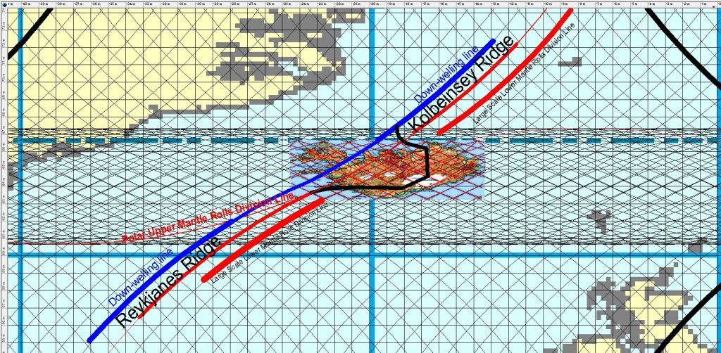
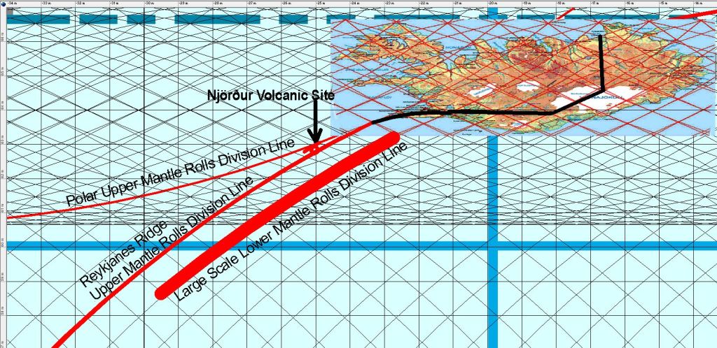
The up-welling large concection rollls of lower mantle flow towards east and west under Iceland. The division line can be pinpointed. It is not directly under the Reykjanes Ridge, because the upper-most convection cells directly above the line have convergent flow. Therefore, the next division line is up-welling, criating the Reykjanes Ridge. Still, the main convection rolls of lower mantle have a ruling effect on tectonic drift, and many interesting places are found along it, or very close to it, including my hometown, Thorlakshofn.

Main destinations along the lower mantle division line.

From Thorlakshöfn, the montain slope called Hlíð marks the line. Then Hveragerði forms a major hub from the effects of different layers of the mantle, manifested by geothermal area. Then the slope of the western margin of the West Volcanic Zone includes Laugarvatn, anogher geothermal area. Geysir is found slightly east of the line, but still on the line of Hekla and Reykholtsdalur. Then we go farther along the edge of Langjökull Glacier, where the mountain range of Jarlhettur forms the division line on the surface. Then we encounter Hveravellir, an area that is dirctly in between the outposts of Icelandic volcanoes, Snæfellsjökull and Snæfell. Finally, in the northern part of Icealnd the line passes slightly east of Akureyri, the capital of the North. Not far from there, Húsavík, with hot spring areas and faults, marks the last landmark for the division line through Iceland.

Uncategorized

The Continuity of Reykjanes Ridge and Kolbeinsey Ridge

Geologists generally are aware of the connection between Reykjanes Ridge and Kolbeinsey Ridge. Here, the relevant convection roll is marked with red line for the up-welling division, and blue line for the down-welling part. By comparing with the exact location of the two ridges, the reason for the connection between them becomes clear.

The Continuity of Reykjanes Ridge and Kolbeinsey Ridge

As latitude and longitude can be easily detected on this map, the consistence between real location and this theoretic alignment can be checked out.

The cnvection roll of Reykjanes Ridge is originally connected at 120 km depth with the tectonic plate, but within the intersection zone it becomes subducted by the polar convection rolls. North of the intersection zone, the convection roll found in between the blue and red lines is also connected with the tectonic plate at 120 km depth, and it is also the upper most roll within the intersection zone.

Kolbeinsey Ridge follows a different path than Reykjanes Ridge, and seems to be a consequence of similar process as creates the volcanic zones of iceland. The Reykjanes Ridge is on the contrary directly related to a single up-welling division line.

Uncategorized

Reykjanes Ridge and Kolbeinsey Ridge Follow the Same Convection Rolls

The two ridges soutn and north of Iceland are actually of the same origin. This can be shown by comparing their location with the convection rolls model. This map shows the alignment of Kolbeinsey Ridge:

Kolbeinsey Ridge as mapped in the article: https://reader.elsevier.com/reader/sd/pii/S0012821X16000510?token=1F7B05FAFE21448B2EFF8D0701F43C3B0DB5F4495595A70607BC3295D75EF6359DAB5D00879E08A8465863AA4CA8BEC6
Reykjanes Ridge and Kolbeinsey Ridge

Within the interval of close to 63°N to 67°N, the two ridges are separated within the intersection zone of convection rolls.

Uncategorized

Njörður Volcanic Site on Reykjanes Ridge

Njörður Caldera is found within the Reykjanes Ridge:

Njörður Caldera. From the book Náttúruvá á Íslandi (2013)

The Reykjanes Ridge resembles a volcanic zone, as we see in Iceland. The volcano is found at a special location, where the upper most polar convection rolls division line does approach the division line between the equatorial convection rolls, responsible for the southern half of the Reykjanes Ridge. The faults stretching northwards from the caldera enter a micropolygon, shaped by four convection rolls layers.

The location of Njörður, and mantle division lines pointed out with red lines for clarification.

The Reykjanes Ridge Polar Upper Mantle Rolls Division Line is up-welling, and works agains the drift direction of the North American Tectonic Plate, resulting in similar rifting process as within the volcanic zones of Iceland.

The Large Scale Lower Mantle Rolls are found deeper below, that is at 410 km depth. The Polar Upper Mantle Rolls upper limit is at 120 km depth, where the tectonic plate (the ductile part of it) meets with the convecting mantle.