Uncategorized

The Scandianvian Convection Rolls

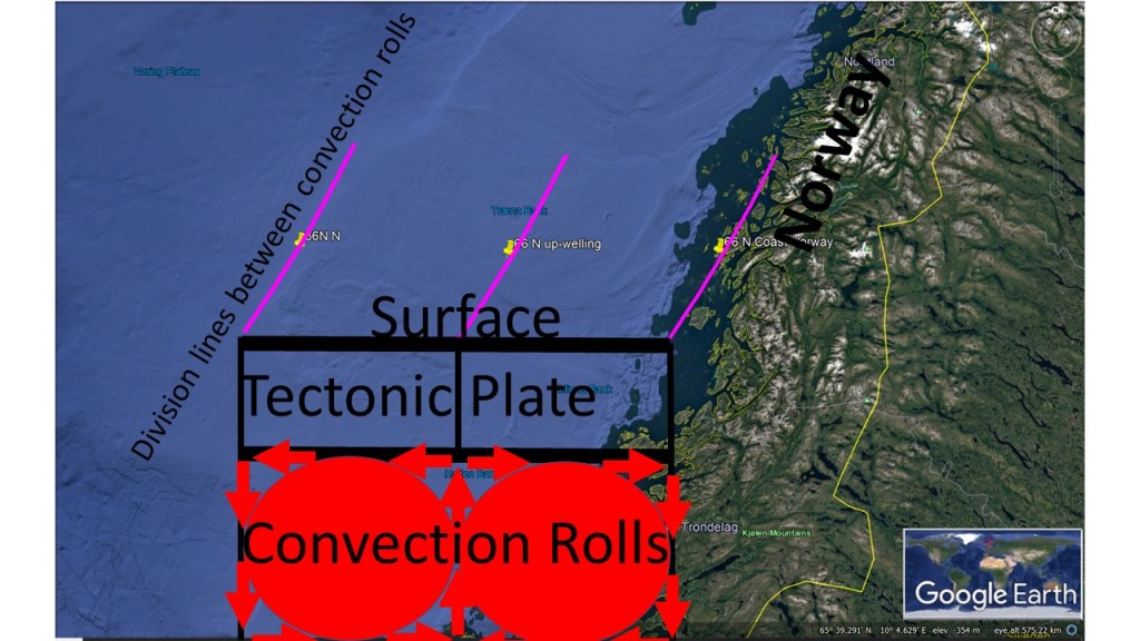
Scandinavia is marked by one convection roll of lower mantle. The coast of Norway is the down-welling side, and the up-welling is found east of the White Sea and Finland.

The Scandinavian Convection Rolls

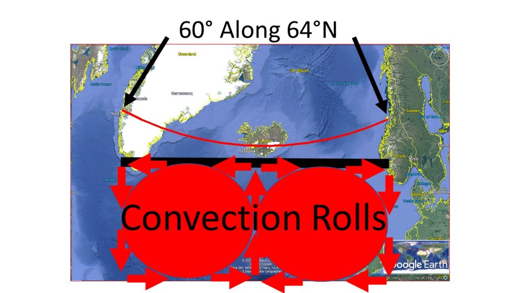
As Iceland is one of the Scandinavian countries, the system of a pair of rolls, with down-welling in the middle, more and less marks the area.

For those really interested, the middle of the Scandinavian Peninsula, and all Iceland, are found within an intersection zone of two different convection rolls, although closely related to each other. The rolls reaching from equator meet the rolls extending to the North Pole.

But for the sake of simplicity, this is the picture we should comprehend at first. Also, please note that this is found within a 3D globe, but this is an over-simplified 2D drawing 🙂

Uncategorized

The Parallel of 66°N Examined

The symmetry around the coastal point of Iceland at 66°N, 30° to East and West, is coherent with the analytical result that the span of one convection roll of lower mantle is 30° along each latitude. Still, the West Fjords Peninsula is not located over the division line of large convection rolls of lower mantle, but the tectonic drift has resulted in this symmetry.

The Symmetry Along 55°N of Coastal and Continental Shelf Points

The coast of Norway is 6° farther to the East (the span of 2 upper mantle convection rolls), where the main division line between lower mantle convection rolls is found. These are down-welling lines closest to the tectonic plate at 120 km depth below Earth’s surface. It is therefore to be understood that at those three points, the down-welling division lines also mark the division lines between topographic and bathymetric features.

Uncategorized

Seljalandsfoss of Eyjafjallajökull

The volcano Eyjafjallajökull became famous in 2010 when it erupted and airports all over Europe were closed. It is located at the western end of the mountain range of Eyjafjöll, and when revealing the mystery where volcanoes are located, the reason for the location of Seljalandsfoss becomes understandable. An EW-axis is found through Eyjafjallajökull, and the caldera of Katla as well.

Seljalandsfoss

The black line found on this map shows how the axis is formed from one corner of the relevant polygon to the other. Seljalandsfoss represents the end of the explicit part of fissure swarm of Eyjafjallajökull.

The location of Seljalandsfoss