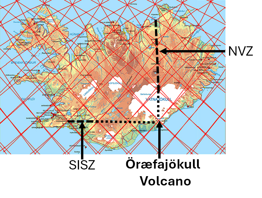
The highest volcano of Iceland is far east of the main volcanic zones. The position is easy to understand when looking at the convection rolls system map. The top of the mountain is above the crossings of the four sets of upper convection rolls found underneath it. Besides that, Öræfajökull is found as a continuation to the south of the North Volcanic Zone (NVZ), and on the same line as the South Iceland Seismic Zone (SISZ) on the 64th parallel.
All other volcanic sites in Iceland can be analysed in a similar way. The Convection Rolls Model is a very effective tool which can be used to better understand the framework of volcanic, seismic and geothermal areas everywhere in the world.
The three papers describe the whole system and its relevance to geological circumstances: Basic description: https://pangea.stanford.edu/ERE/db/WGC/papers/WGC/2020/13040.pdf?t=1612656487
Divergent boundaries: https://pangea.stanford.edu/ERE/db/GeoConf/papers/SGW/2023/Thorbjarnarson.pdf,
Convergent boundaries: https://pangea.stanford.edu/ERE/db/GeoConf/papers/SGW/2024/Thorbjarnarson.pdf.
