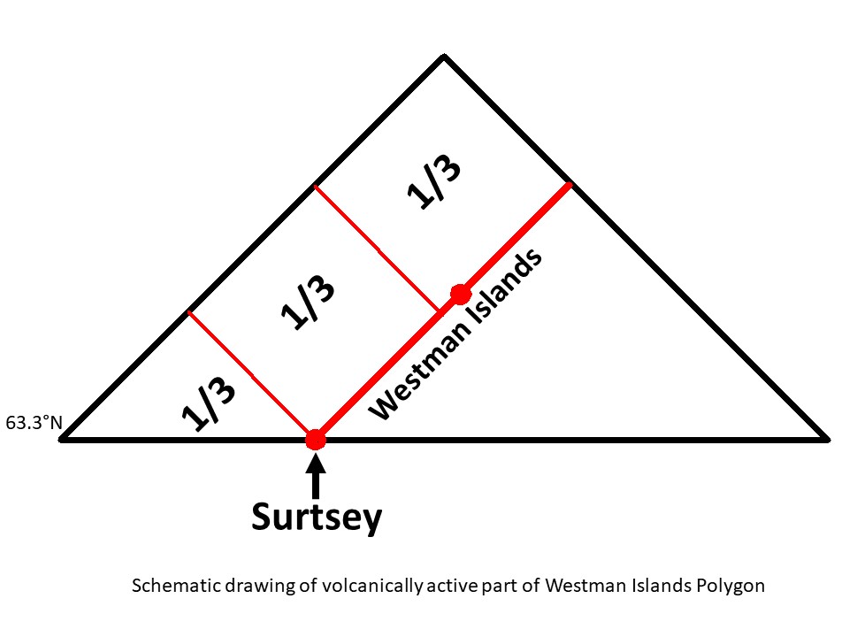
The Westman Islands are mainly distributed along a line from SW to NE, and Surtsey happens to be the outermost point to the SW. The outer framework is a polygon, of which only the northern half is volcanically active. The polygon is subject to the effects of tectonic drift and magmatic intrusion, and tends to be divided into regular parts. First, an E-W axis is formed, as is common for other polygons nearby. Then, the northern half is divided into roughly 3 parts, as shown here:
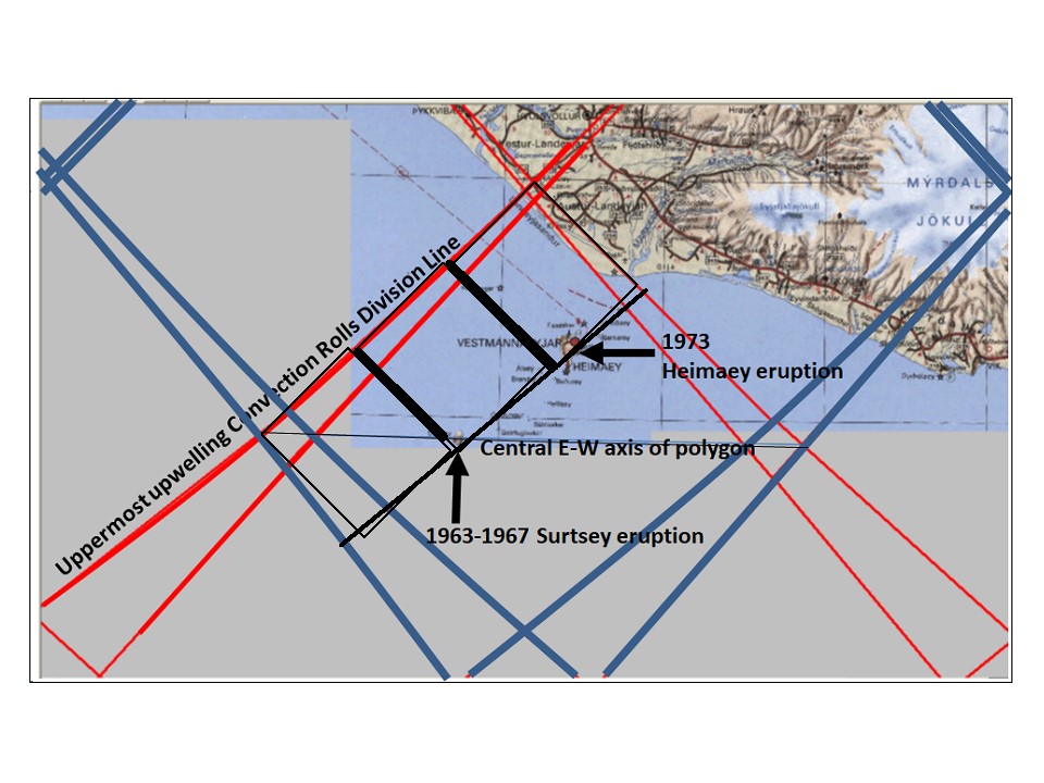
The real picture is of course somewhat more complicated, as seen here:
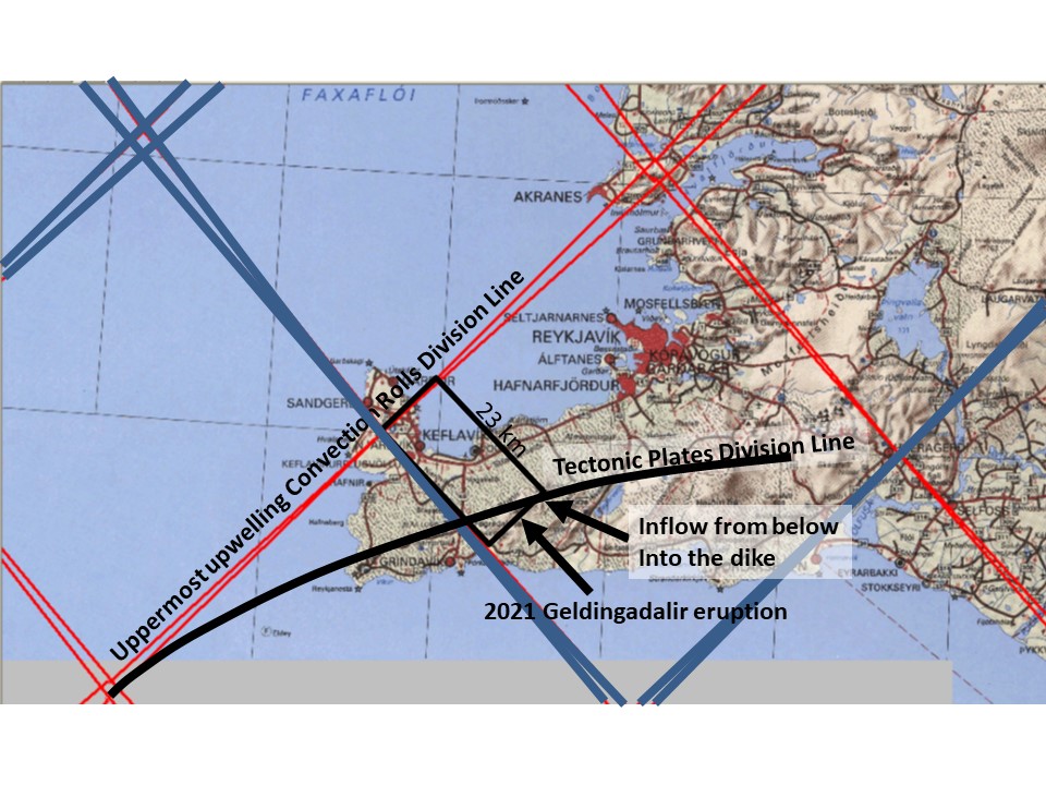
Looking at the Geldingadalir eruption, the 1/3 divisions are also dectable there, but partly distorted because the division line between N-America and Eurasia is swayed, so a direct E-W axis between east and west corners does not form.
The similarities between the two polygons are striking, and it is curious that these somewhat parallel events occur within a century. This is also one clue about the eventual duration of the Geldingadalir eruption.
