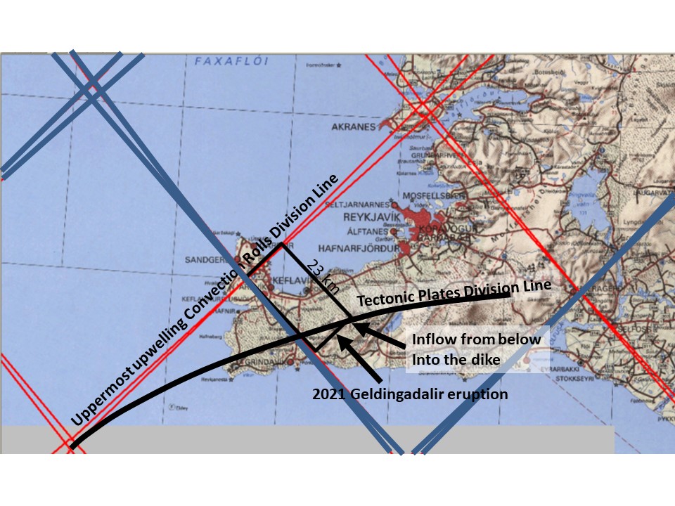
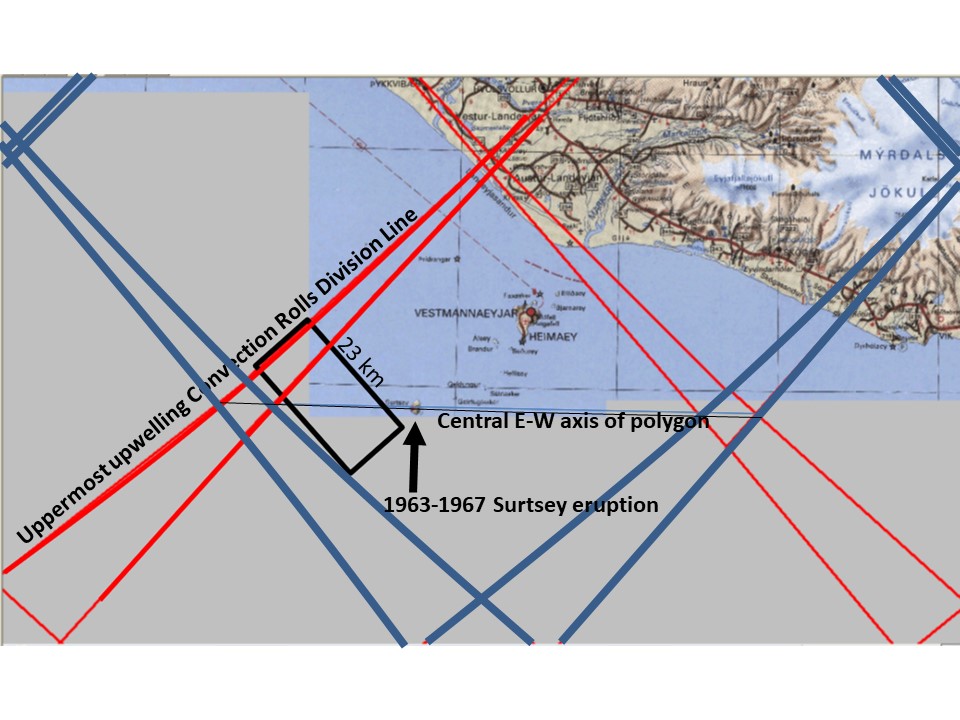
Noticing the similarities between the two eruptions of Geldingadalir and Surtsey, we should also be aware of the differences. Let us have a look at the maps:
Geldingadalir eruption for comparison with Surtsey eruption.Surtsey eruption for comparison with Geldingadalir eruption.
Identical squares with the length of 23 km have been inserted for orientation. The similarities can partly be explained referring to the central axis of the Westman Islands Polygon on one hand and the division line between the N-American Tectonic Plate and the Eurasian Tectonic Plate on the Reykjanes Peninsula on the other hand.
I am a geologist, graduated from the University of Iceland, and taught geology for a few years. I have gained some knowledge about Earth's inner structure, so I provide this website as my contribution to answer one of the greatest questions remaining within the realm of geoscience. Experiments show that the mantle should form convection rolls when close to the melting point. I took this literally, and calculated the dimensions and shape of these mantle convection rolls. Then I compare that model with the surface. This makes it possible to provide many interesting examples about geology found on my blog.
View all posts by Steingrimur Thorbjarnarson