It can be confusing when seismic and volcanic activity is intervowen as at the Reykjanes Peninsula. Luckily, we have good information about the tectonic drift in the area, measured with GPS technology. The results are found in this report https://www.lmi.is/static/files/utgefid_efni/Maelingar/isnet_endurmael_2016_skyrsla.pdf.
On this map, I have superimposed the grid on the original map from the Icelandic Land Survey showing tectonic drift vectors.

The drift vectors show the rotation taking place within the Reykjanes polygon. Further analysis provides this drawing:
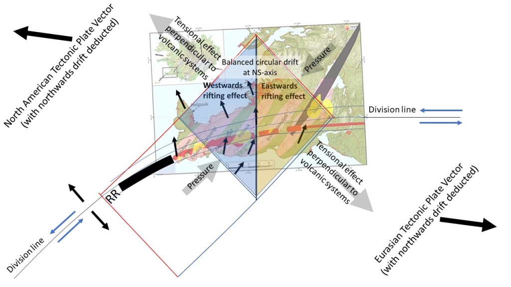
The small black arrows indicate the unaltered drift directions measured directly with GPS stations. It can be reasoned that the rifting process of the volcanic systmes is perpendicular to the main tensional effect within the area, indicated with light gray arrows. Similarly, pressure is excerted, creating the earthquake faults with NS alignment. The western half of the polygon seems to rotate in a semi-circular way with center at its western corner, but is at the same time subject to rifting process to the west. Similarly, the eastern half is subject to rifting to the east as compared to the NS axis of the polygon.
The earthquakes at Reykjanes Peninsula show resemblance to the volcanic systems, but occur on NS faults. This should be due to an interplay between tension and pressure within the polygon.
