Comparing the unique earthquake swarm occurring today with the mathematical continuation of Reykjanes Ridge and the relevant mantle convection rolls, this pattern emerges:
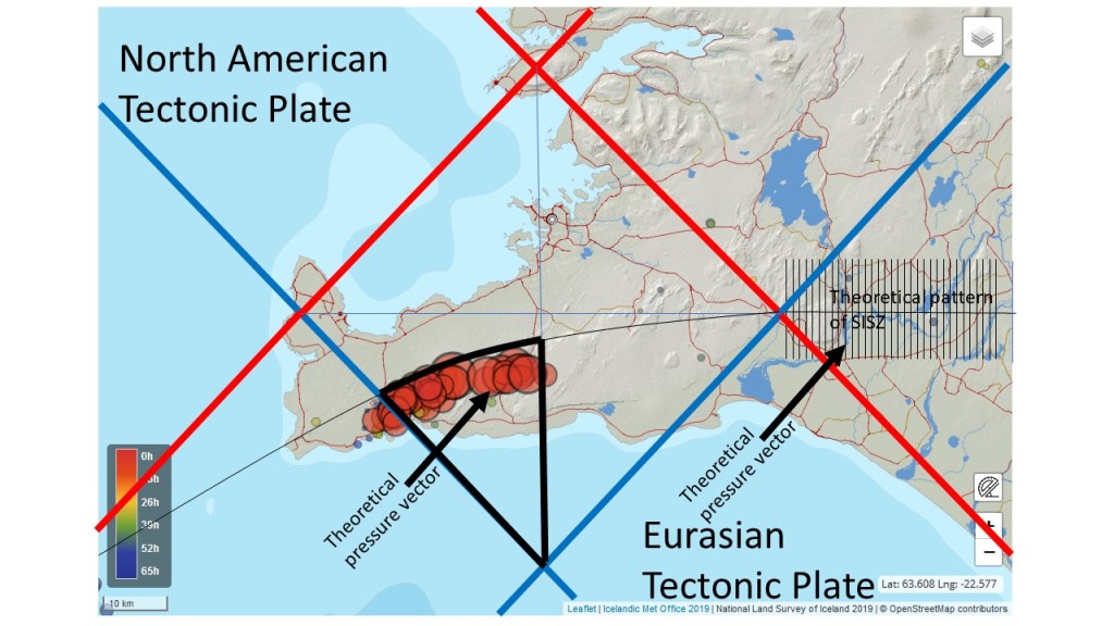
The earthquake swarm spans over an area within one quarter of the polygon. The faults pattern of the South Iceland Seismic Zone are shown for comparison. The faults continue into the Reykjanes Polygon, but due to the swaying effect of the central axis of the seismic zone system, the faults are likewise forced to appear farther to the south. The faults remain NS oriented within the Reykjanes part of the seismic system. Earthquake seem to occur mainly south of the central tectonic division line, as can clearly be seen on this map. The NS axis of the polygon is surprisingly decisive, resulting in a ‘1/4 pattern’ of the swarm.
Red lines show upwelling, blue lines show downwelling. The polygon is simplified and superimposed on a map from the National Land Survey of Iceland.
