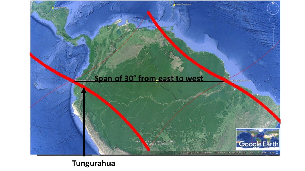
The Amazon area is mostly found within a large polygon marked by the division lines of each side of a single convection roll of lower mantle. The main hub of downwelling forms the esturary of the Amazon River, the largest river in the world. At the other side of the continent, the division line (wide red) between convection rolls does cross the Andes Mountains under the volcano Tuguruahua.
The polygon of Amazon area
The exact 30° span along equator from the trench in the east to the estuary in the west is an outstanding manifestation of the predicted interval between convection rolls of the lower mantle.
I am a geologist, graduated from the University of Iceland, and taught geology for a few years. I have gained some knowledge about Earth's inner structure, so I provide this website as my contribution to answer one of the greatest questions remaining within the realm of geoscience. Experiments show that the mantle should form convection rolls when close to the melting point. I took this literally, and calculated the dimensions and shape of these mantle convection rolls. Then I compare that model with the surface. This makes it possible to provide many interesting examples about geology found on my blog.
View all posts by Steingrimur Thorbjarnarson