The rift zone ´jumps´ in Iceland are well known, occurring every 7 million years or so. The central axis of these zones have been mapped, and the regularity of interval between them can be detected easily. One volcanic zone has hitherto not been included, because it is not a rift zone. All the same, it fits into the pattern of regularity. The wide red lines are upwelling division lines between uppermost convection rolls. These rolls interact with the tectonic plate at the depth of 120 km.
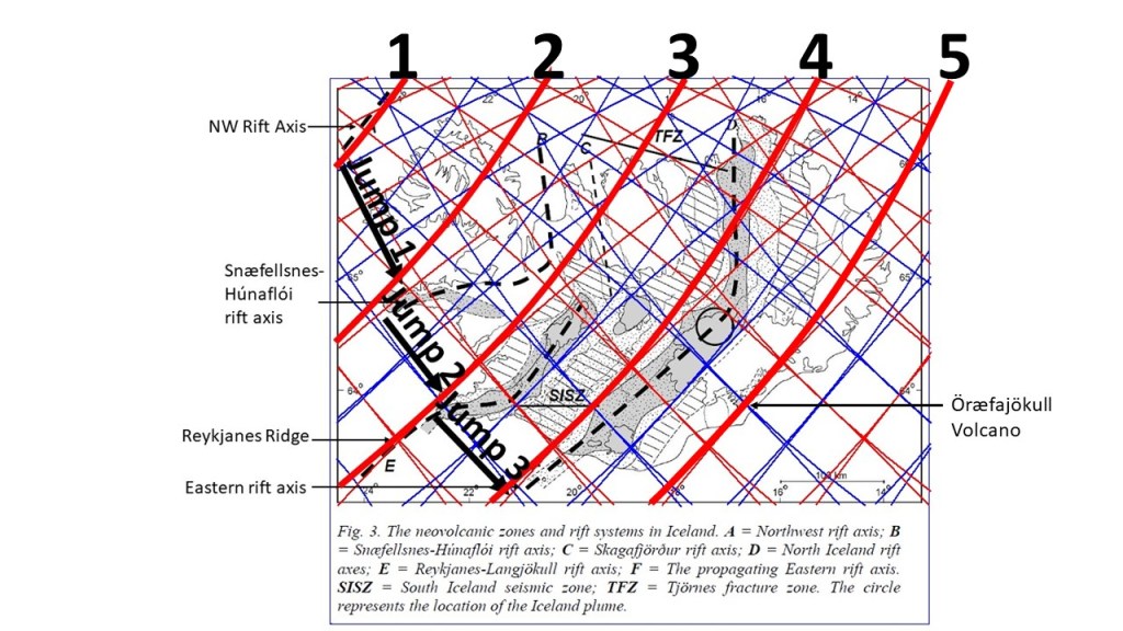
The NW rift axis and the Snæfellsnes-Húnaflói rift axis are extinct, but Reykjanes Ridge and the Eastern rift axis are active. Öræfajökull is found on the fifth line.
The basic map is found in: https://www.semanticscholar.org/paper/The-Skagafj%C3%B6r%C3%B0ur-Volcanic-Zone-An-ephemeral-Rift-Hjartarson/3e8f5295fd6fe47e9f336c53d285fd76f44904ee
