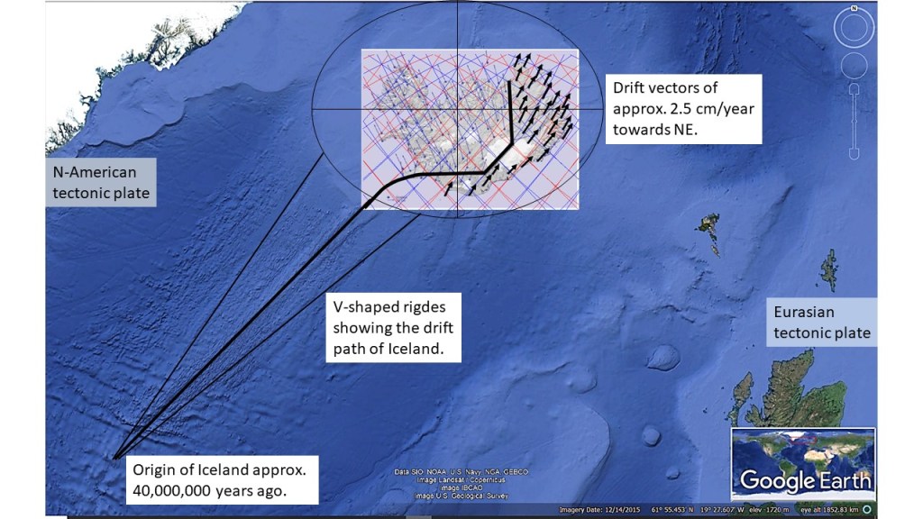
The origin of Iceland can be traced according to recent measurements. Following the drift vectors of the Eurasian Tectonic Plate backwards, we find the exact point.
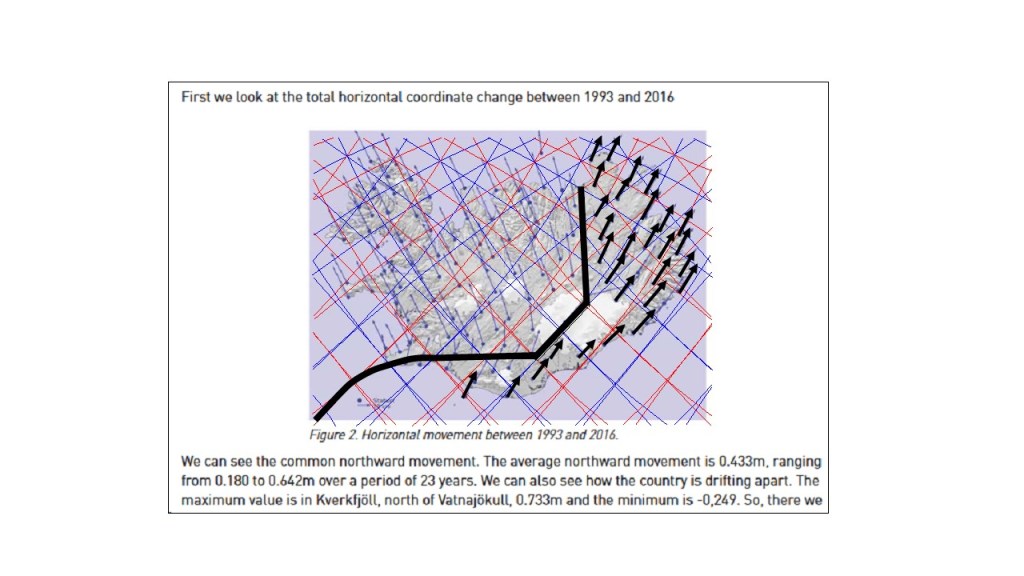
The drift vectors can be measured in the eastern half of Iceland with GPS technology. The report is published here: https://www.lmi.is/static/files/utgefid_efni/Maelingar/isnet_endurmael_2016_skyrsla.pdf
The V-shaped ridges are in fact not perfectly symmetrical around the Reykjanes Ridge Central Axis, because the N-American Tectonic Plate drifts perpendicularly to the ridge. Symmetry is found around the North Volcanic Zone of Iceland, though, because it is aligned directly from north to south.
For clarification, I also include the map fram the National Land Survey of Iceland, along with the relevant text:
This might seem contrary to what is shown on most geology maps, showing the drift vectors of the Eurasian Plate towards the east, or slightly south of east. It is simply because most geoscientists choose to omit the northern drift component, emphasizing on the divergent effect of the tectonic drift.
The V-shaped ridges have been found to be the result of propagating anomaly along the Reykjanes Ridge. A good article is found here: https://agupubs.onlinelibrary.wiley.com/doi/10.1029/2002GC000361
The variations in melt production rate at the Mid‐Atlantic Ridge (Reykjanes Ridge) extend to the point where Iceland started to form, and the southern more Charlie Gibbs Fracture Zone explains how the two plates of N-America and Eurasia have been drifting away from each other, while the drift vectors have not been directly opposite to each other.
