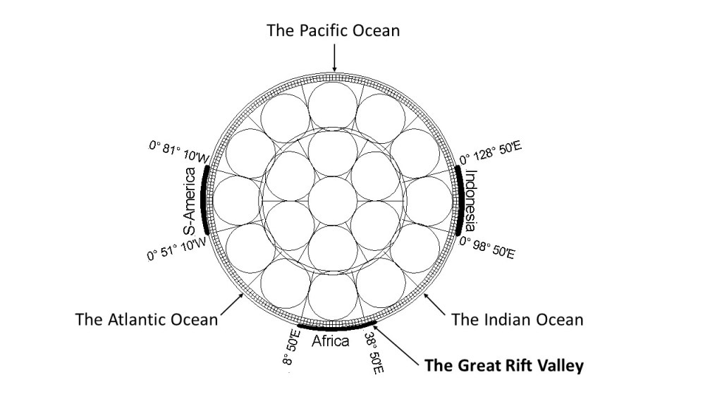
The arrangement of sea and landmass along equator is regular as shown here:
Section view of equator – land mass shown with thick lines. Distribution is not random. 1) S-America, Africa and Indonesia form 90° angles. 2) Land covers 30° sections of equator. 3) The ridges of the Atlantic and Indian Oceans are found at 30° distance from coast at each side.
The pattern along equaor of 30° span of S-America, 60° span of Atlantic Ocean, 30° of Africa from west coast to Great Rift Valley, 60° from Great Rift Valley to Indonesia, 30° from west coast of Indonesia to east coast of Indonesia, is quite obvious. Moreover, the pattern fits with the arrrangement of convection rolls within the mantle, considering that mantle material convects in rolls of equal hight and width under balanced conditions of flow.
The proof is found with the location of the Great Rift Valley, as it is not found in context with coast-to-coast distance, but from the west coast of Africa over to a geological phenomena within the continent, that is clearly there due to the inner forces of Earth.
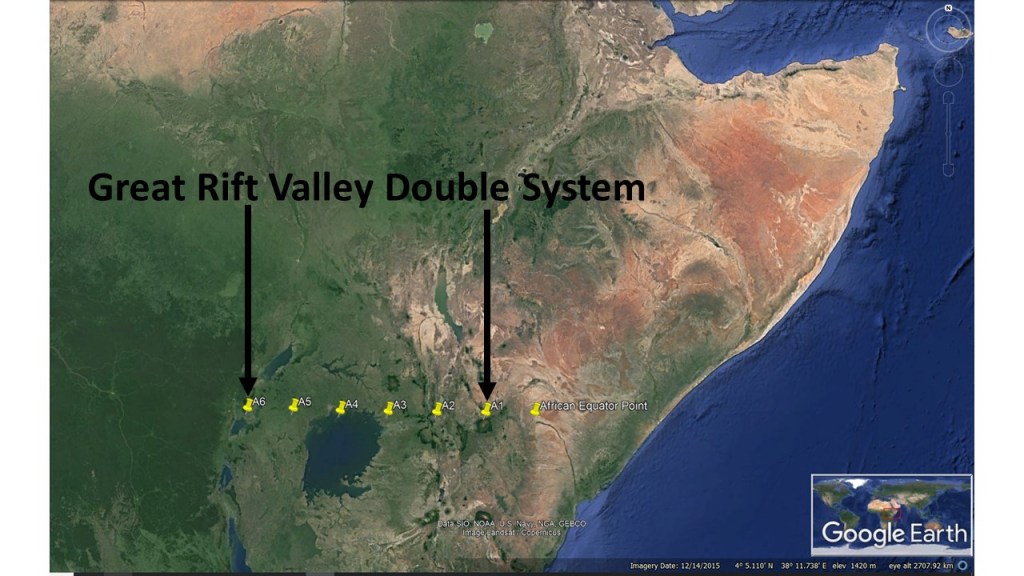
To further examine the distribution of geological features, one can ‘zoom in’ on the Great Rift Valley, and see how it does comply in detail with the upper most convection rolls, close to the tectonic plate.
I am a geologist, graduated from the University of Iceland, and taught geology for a few years. I have gained some knowledge about Earth's inner structure, so I provide this website as my contribution to answer one of the greatest questions remaining within the realm of geoscience. Experiments show that the mantle should form convection rolls when close to the melting point. I took this literally, and calculated the dimensions and shape of these mantle convection rolls. Then I compare that model with the surface. This makes it possible to provide many interesting examples about geology found on my blog.
View all posts by Steingrimur Thorbjarnarson