Scenic areas appear in context with forces of nature. The Diamond Circle contains Goðafoss Waterfall, Mývatn Lake, Dettifoss Waterfall, Ásbyrgi Canyon, Húsavík Hot Springs and eventually the town of Akureyri.
Here some explanations are made:
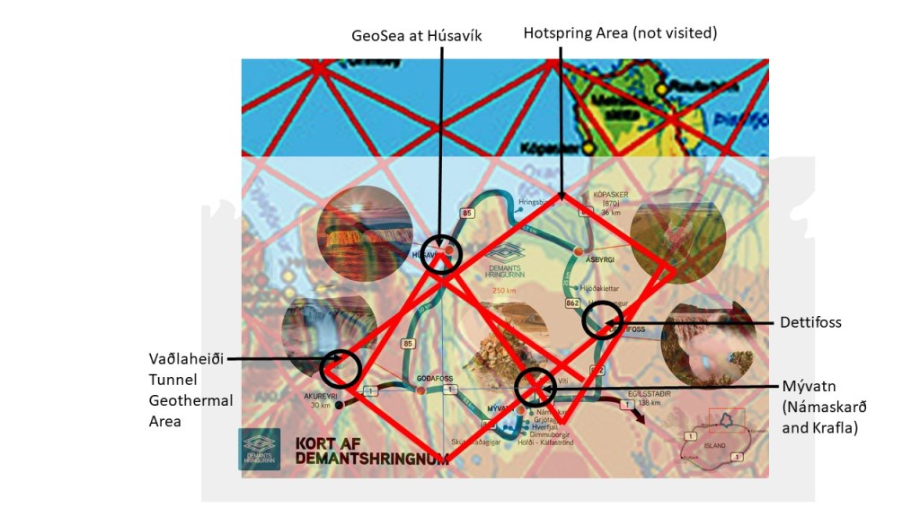
1. Vaðlaheiði Tunnel goes right through a division line between mantle rolls. 2. Goðafoss is at the EW axis of the relevant polygon. 3, Mývatn area with Krafla and Námaskarð are located ath the edge of a mini-polygon. 4. Dettifoss is at border line of two polygons, providing conditions for a division between highland and lowland areas. 5. Húsavík is on the main division line of lower mantle. At Öxarfjörður a major geothermal area is found, still not included in the circle. The polygons provide clear topographical NS features, including Ásbyrgi.
The analysis thereby provides some explanation for all the sites. Description is found at the website https://www.northiceland.is/diamondcircle

The tectonics of the area of Dettifoss follow the upper most convection rolls of 120 km below the surface. The formula shows exactly the direction of the tectonic feature creating the edge of Dettifoss Waterfall.
