Mývatn is a major area of tourism, marked by the relevant division lines:
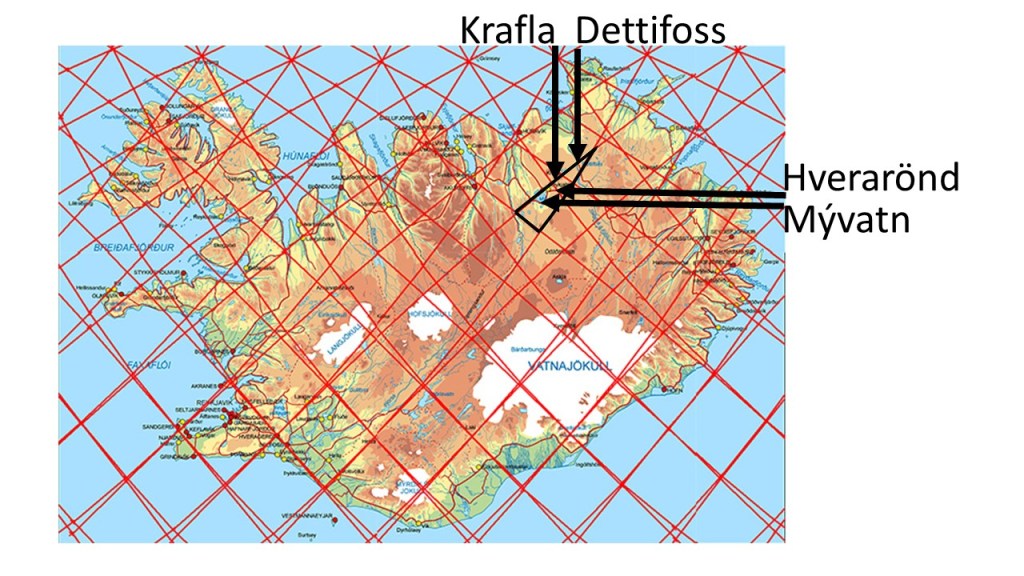
A division lines of lower mantle and the polar system division line of Hekla mark the area. The coast of Mývatn follows topography of the edge of the lower mantle division line. Farther to the NE, Krafla Volcano is on the edge of the mini-polygon. Then go farther still to the NE to find Dettifoss. The hot spring of Hverarönd are found at the SW edge of the mini-polygon.
A closer look is necessary to fully comprehend how the convection rolls division lines make the preconditions for these natural scenic spots to form.
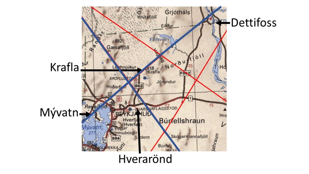
The pattern is complicated, but each line has a function here. This can be compared with other mini-polygons, like Kverkfjöll and Reykholtsdalur, and of course the areas of same latitude near Akureyri and Sauðárkrókur, where the same pattern is repeated with 1.5° interval. Here, the pattern coincides with the main division between the tectonic plates of N-America and Eurasia, resulting in these amazing features, tectonic, geothermal and volcanic activity.
