Fuji in Japan and Hawaii have similar relation to the main division lines of lower mantle. Therefore they are found 60° apart, as shown on this drawing:
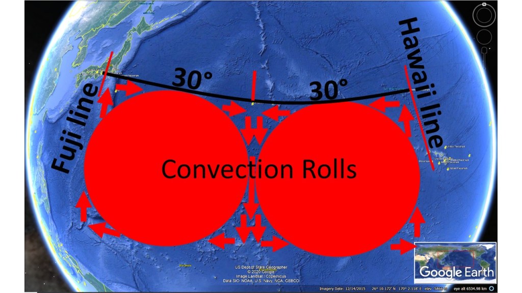
Both areas are located on up-welling lines. The main chain of Hawaii spans 30° from east to west, from Hawaii Island itself to the southern end of the Emperor Chain. The background of that turn is therefore more complex than most people think (the common explanation that the tectonic drift just made a turn one day due to changes elsewhere). Today, the Hawaii chain seems to be developing southwards. The drawings of convection rolls represents a vertical section of the rolls. The ridge extending south of Japan is therefore one of the main manifestations showing the location and shape of the convection rolls within the mantle. The detailed analysis has to be made with the map of the upper-most convection rolls, understanding the implications within the volcanic areas of Japan and Hawaii Islands. But with this general section in mind, the exceptional volcanism of Japan and Hawaii becomes much easier to understand. Note that the volcanism in Hawaii has to be explained according to at least two small scale rolls, spanning 2×1.5° from east to west. The volacanism is found where certain conflict is found between the large scale convection roll of Central Pacific and the general tectonic drift direction. Once the sea floor is pulled over to the convection roll west of the volcanic islands, volcanism ceases.
