The Amazon basin is aligned predominantly west–east, and the Amazon estuary lies on the Equator. According to the convection-rolls model, this estuary is situated on a major downwelling division line between large lower-mantle convection rolls.
In addition, 30° westward along the Equator from the Amazon estuary lies the west coast of South America, where a deep oceanic trench is present. This trench corresponds to another division line of large scale lower mantle convection rolls associated with the implications of uppermost mantle convection rolls of the asthenosphere.
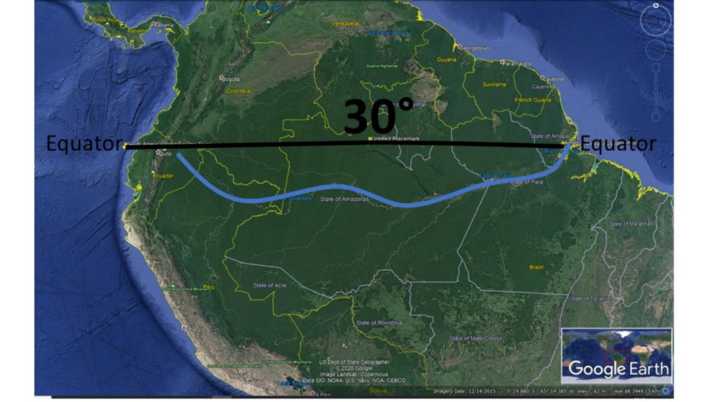
South America spans roughly 30° of longitude along the Equator, from the Amazon estuary to the Pacific margin. This is followed by an approximately 60° longitudinal span along the Equator across the Atlantic Ocean to Africa (with the Mid-Atlantic Ridge in the middle, and therefore we have two 30° steps across the ocean), and then a further 30° span from the west coast of Africa to the Great Rift Valley. At each of these longitudinal intervals, a division line between major lower-mantle convection rolls can be identified.
The Amazon River, marked approximately by a blue line, closely follows the equatorial parallel and appears to be structurally guided by this deep mantle boundary. This spatial correspondence suggests that large-scale mantle convection geometry exerts a first-order control on continental-scale river systems, plate boundaries, and major tectonic features.
