The Coast of Norway follows the edge of a mantle convection roll. This can be seen on this map:
Theoretical Location of the Coast of Norway, as Compared with the Convection Rolls Model of the Earth. Each Circle Marks a Section of a Convection Roll
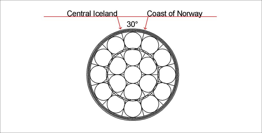
The span from central Iceland to coastal Norway is 30°, the same as the span of a convection roll of the lower mantle. According to GPS measurements, Norway is drifting along this division line. This can be roughly explained with this drawing:
Coast of Norway Compared with Convection Rolls of Lower Mantle (not to scale)
The wide black line along the coast of Norway shows the division line between the large convection rolls.
Question: Why are the convection rolls in the upper picture round, the lower has elongated rolls?
Answer: Because the upper one shows a slice along the latitude 64°N, whlie the lower indicates the vertical section compared with surface (convection rolls perpendicular to surface plane).
I am a geologist, graduated from the University of Iceland, and taught geology for a few years. I have gained some knowledge about Earth's inner structure, so I provide this website as my contribution to answer one of the greatest questions remaining within the realm of geoscience. Experiments show that the mantle should form convection rolls when close to the melting point. I took this literally, and calculated the dimensions and shape of these mantle convection rolls. Then I compare that model with the surface. This makes it possible to provide many interesting examples about geology found on my blog.
View all posts by Steingrimur Thorbjarnarson