One aspect of science and proof is repeated occurrence. This is found in Central Iceland where four axis of volcanic activity appear parallel to each other, each occupying one of identical polygons of the convection rolls system under the country:
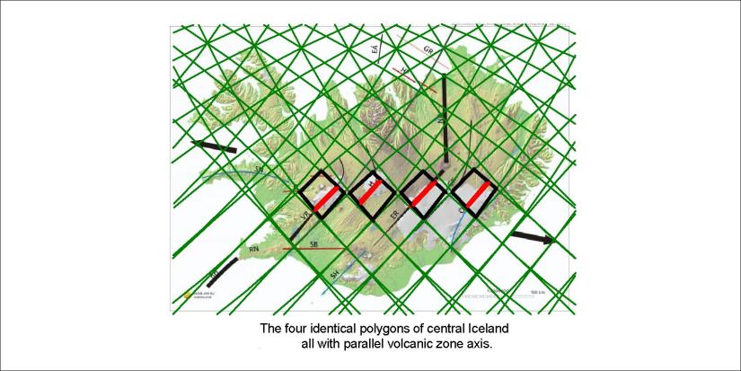
By simply adding a red line on the lines of the original ISOR map, it can be seen how each volcanic zone occupies one polygon. One of them is the main rift zone, the ER-line. These polygons are all east of the Reykjanes Ridge. The Snæfellsnes Belt is found at a similar latitude, and is due to forces acting to a different direction, that is NW and therefore takes on a different orientation.
Published by Steingrimur Thorbjarnarson
I am a geologist, graduated from the University of Iceland, and taught geology for a few years. I have gained some knowledge about Earth's inner structure, so I provide this website as my contribution to answer one of the greatest questions remaining within the realm of geoscience. Experiments show that the mantle should form convection rolls when close to the melting point. I took this literally, and calculated the dimensions and shape of these mantle convection rolls. Then I compare that model with the surface. This makes it possible to provide many interesting examples about geology found on my blog.
View all posts by Steingrimur Thorbjarnarson
