How to explain the existence of the EVZ and Katla volcanic system? We can analyze it by looking at the convection cell system, its lines and polygons. Katla takes over two polygons as shown here:
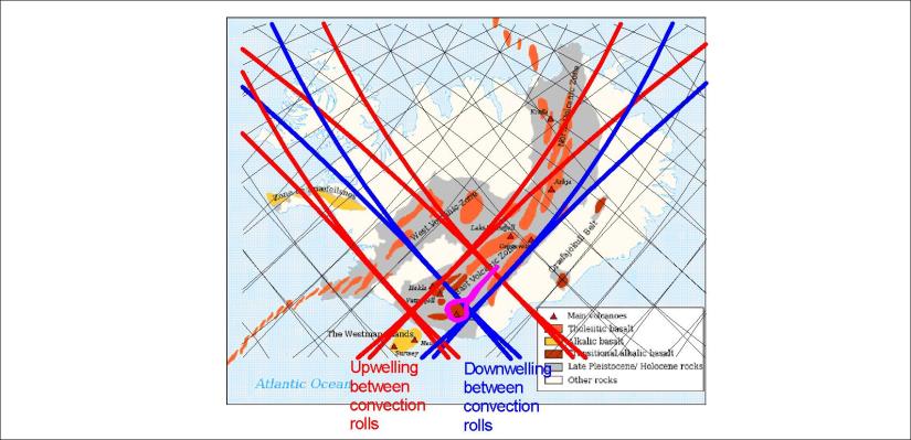
The four lines are all downwelling. The caldera is found in the east corner of the southern polygon. When magma finds its way out of the caldera, it flows along the fissures exactly from one side to another of the northern polygon. The tension is created by the conflict between large scale tectonic drift, pulling from NE to NW, and the small scale (1.5° wide) pulling of the uppermost convection roll under the EVZ from NW to SE.
To see this more clearly, zoom in a bit:
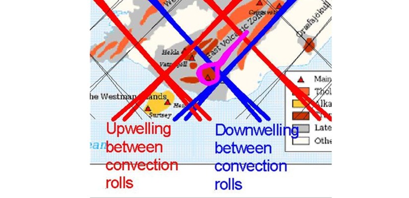
The violet color shows Katla Volcanic System, both caldera and the fissure swarm extending to the NE. The other fissure swarm, extending from NE to SW, is the Grímsvötn system, where the caldera is also found adjacent to a corner of the relevant polygon.
