The large convection cells within the Earth according to analysis of a model where rolls are formed with identical height and breadth. S-America and Indonesia are ‘mirrored’:

This amazing fact can be elaborated on in countless ways. Let us compare two points:
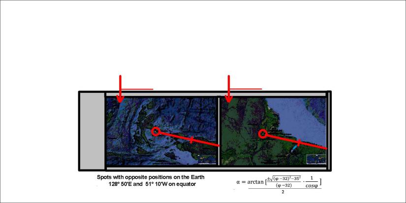
These pictures show how the coasts of S-America and Papua follow the same trend. The trend can be calculated as for horizontal forces at 0° latitude, about 12.5° compared with EW-axis. As the red arrow show, identical tectonic features appear exactly the same distance away from the division point of convection rolls at equator, marked with yellow position pin of Google map inside the red circles.
Published by Steingrimur Thorbjarnarson
I am a geologist, graduated from the University of Iceland, and taught geology for a few years. I have gained some knowledge about Earth's inner structure, so I provide this website as my contribution to answer one of the greatest questions remaining within the realm of geoscience. Experiments show that the mantle should form convection rolls when close to the melting point. I took this literally, and calculated the dimensions and shape of these mantle convection rolls. Then I compare that model with the surface. This makes it possible to provide many interesting examples about geology found on my blog.
View all posts by Steingrimur Thorbjarnarson
