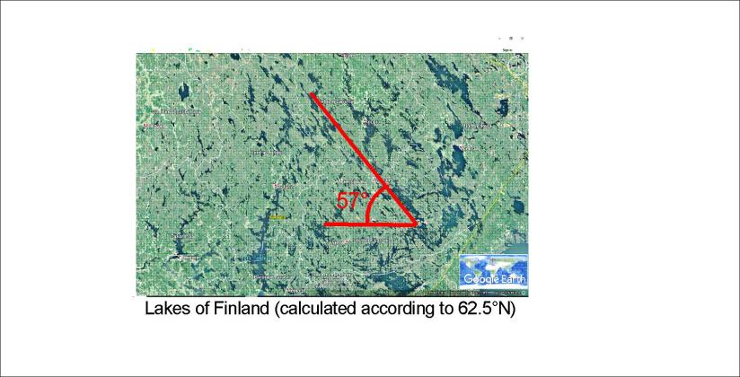
Finland is a country of lakes. The glacier of the ice age did dig out these sites of peaceful surroundings. One can easily find a certain direction many of the lakes follow. Calculating according to Coriolis Effect the path of mantle convection rolls fits exactly to this alignment. This can be shown on the base of a Google map:
It is just amazing how accurately these calculations fit for tectonics and topography.
This can be calculated because the convection rolls sway according to the difference of rotation speed of the Earth from one latitude to another in a perfectly regular way. This is the same effect as governs the path of wind and sea currents. The mantle under Finland has made way for the glacier in harmony with the alignment of convection rolls.
I am a geologist, graduated from the University of Iceland, and taught geology for a few years. I have gained some knowledge about Earth's inner structure, so I provide this website as my contribution to answer one of the greatest questions remaining within the realm of geoscience. Experiments show that the mantle should form convection rolls when close to the melting point. I took this literally, and calculated the dimensions and shape of these mantle convection rolls. Then I compare that model with the surface. This makes it possible to provide many interesting examples about geology found on my blog.
View all posts by Steingrimur Thorbjarnarson