It is said that the name Norway is actually shortening of Norðurvegur, that is Northern Way. It refers to a sailing route between the island Karmoy and the mainland of Norway. The whole area is actually aligned N-S, as can be seen here:

The N-S oriented tectonics have their origins in the symmetry of the relevant polygon.
Here it is marked with red:
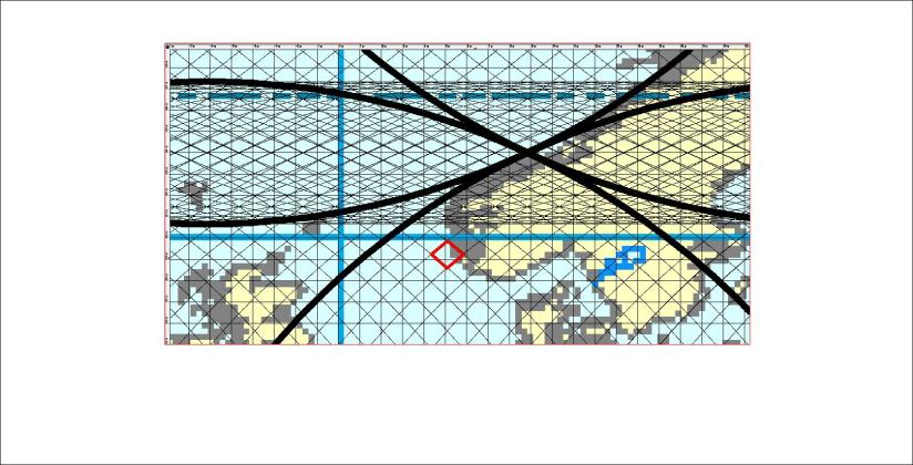
The coasts of Karmoy are at the central axis of the relevant polygon.
Published by Steingrimur Thorbjarnarson
I am a geologist, graduated from the University of Iceland, and taught geology for a few years. I have gained some knowledge about Earth's inner structure, so I provide this website as my contribution to answer one of the greatest questions remaining within the realm of geoscience. Experiments show that the mantle should form convection rolls when close to the melting point. I took this literally, and calculated the dimensions and shape of these mantle convection rolls. Then I compare that model with the surface. This makes it possible to provide many interesting examples about geology found on my blog.
View all posts by Steingrimur Thorbjarnarson
