Today there two earthquakes were measured at Bárðarbunga – 3.9 on Richter Scale. Besides that, water from its geothermal areas probably finds it way from there to the river Jökulsá á Fjöllum.
In 2014 the volcanic site of Bárðarbunga erupted. It was called the Holuhraun eruption, because the lava came up to the surface about 45 km away from its place of origin. How can magma flow so far, thereby forming a dyke, and then eurupt? The bedrock around is much colder, cooling the magma down over such a long distance. By looking at a map of convection cell system it becomes understandable.
First the magma did flow to the SE, perpendicular to the rift zone! It is explainable, because the convection cell system under Iceland always provides lines more and less perpendicular to each other forming polygons. Then the magma turned 90° to the NE along the rift zone. When close to the NE edge of the polygon it turned to the north, and on the relevant line turned slightly to the right and over to the next intersection line between two adjacent convection rolls. Then eruption occurred, the largest lava flow in Iceland for 230 years!
The explanation must be that extra magma was added from below, when the dyke material was flowing above the convection rolls line, causing it to erupt.
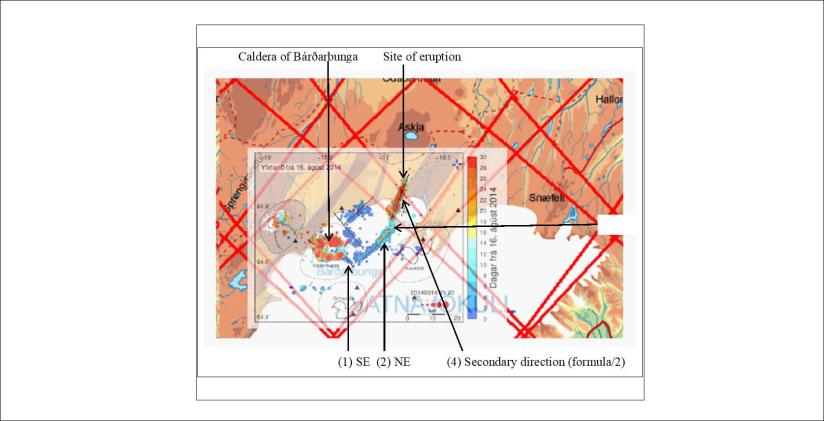
The drawing shows how I combined information from the Icelandic Meteorological Office Web Site with the lines formed by the convection rolls below. It is curious enough that all the directions resemble calculations, and similar calculations can be repeated for tectonics all around Iceland.
