Uncategorized

How did Thingvellir become Iceland’s most special geologic site?

Þingvellir

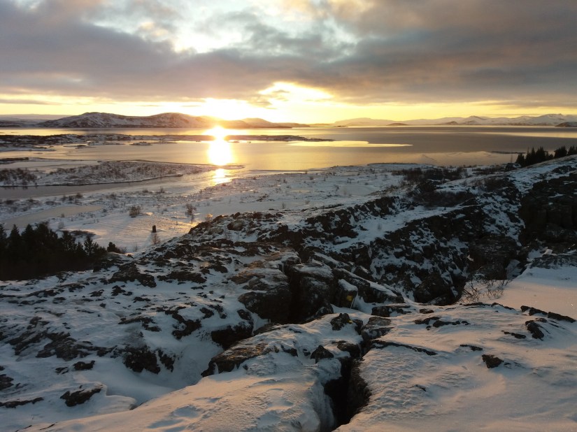
A view over the main rift of Thingvellir, extending to the lake Thingvallavatn.

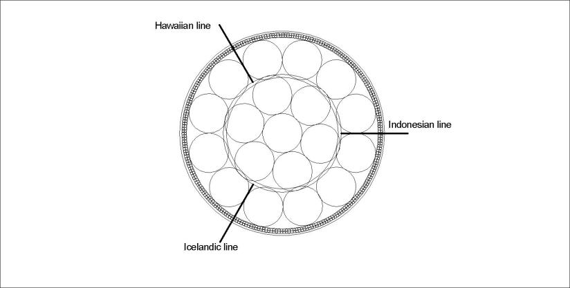
The location of Thingvellir is quite special and makes us combine geology and history in a very special way. But why are the walls of the rift so prominent in the area of Almannagjá and its surroundings? It can be seen on geology maps, and by analyzing the convection cells underneath. Whereas the lake is at the western edge of the Western Volcanic Zone of Iceland (with direction α), the volcanic system of Hengill (with the direction (3/4)α, a large scale rift valley (with the direction (1/2)α, and the NS axis of the relevant polygon of mantle convection cell division lines.

Thingvellir can therefore be explained by referring to the basic formula of convection cells and the derived main tectonic alignments:

Thingvellir - tectonic background and reason for rift valley - formula

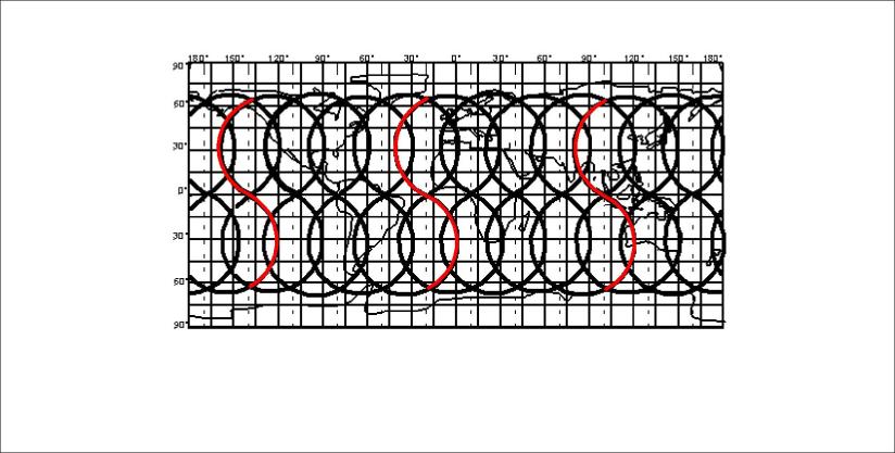
Can you find Thingvellir there? And the relevant tectonic alignments?

Thingvellir - arrow

Please check a detailed geologic map of Iceland and trace the relevant tectonic settings. Then you see why Almannagjá and Hrafnagjá are located where they are 🙂


Uncategorized

Speciality of Hekla volcano

Hekla is the most outstanding volcano of Iceland. It is not the biggest, not the most dangerous, but the most famous one. According to the analysis presented here, it is located above an upwelling line of mantle convection rolls. The mountain is relatively young, as geologists find it to be mostly made of 3000 years old rock or younger. It last erupted in the year 2000. It looks like a boat with the keel turned upwards, and has to be classified as a mixture of a ridge forming on a fissure swarm and a proper stratovolcano. It is located at a spot where four different convection cell layer division lines cross exactly under the mountain’s top crater. Therefore it is often mentioned in scientific articles that it looks like the volcano has different sources of magma. The mountain can be regarded as the central point of volcanic activity in Iceland, manifested by the fact that the distance to the volcanoes farthest in the east and west, Snæfellsjökull and Snæfell, is exactly the same!

Uncategorized

The convection cells below the tectonic plates of the Earth

The convection cells of the mantle are symmetric and stable, constantly affecting our surroundings for billions of years. The basics are so simple that words are not necessary. Just have a look at this sketch below:

Convection cells - basic two rolls

The Reykjanes Ridge is a good example, with a pair of convection cells underneath. These convection rolls extend over all the globe. The subject introduced here as the Convection Cell System of the Mantle is therefore based on a very simple precondition. How this section is then extended over the entire globe and all the relevant implications is of course a bigger piece to swallow 🙂

Uncategorized

The discontinuities at 410 and 670 km depth – regular convection layers!

With the precondition that convection takes place in a regular way, with equal height and width, it is easy to show that the main discontinuities at 410 km and 670 km are found where different convection cell layers meet.

Main layers 410 km and 670 km

Convection rolls of Earth’s mantle

As shown above, the convection rolls fit exactly to the measured layers. The intersection between the rolls is always of the same proportion.

The lower rolls below 410 km depth are found within the larger rolls of the lower mantle. It explains why volcanic activity can follow the tectonic drift above, for instance the Cameroon line of volcanic activity in Africa.

Uncategorized

Convection rolls division lines of Iceland, Hawaii and Indonesia

It becomes easy to comprehend the activity of Iceland, Hawaii and Indonesia when looking at the convection cells pattern. The 2D sketch of equator plane is:

Iceland - Hawaii - Indonesia - lines

And the relevant world map of the same lines is then:

Lines - Iceland - Hawaii - Indonesia - surface

Where the lines for Iceland, Hawaii and Indonesia are marked red.

All this can be derived from one simple precondition: Stability conditions of the mantle.

Once understanding what this means, calculations can replace compiling data in many cases, saving effort and money on a grand scale.