Down below, The NW Peninsula of Iceland (Vestfjarðakjálkinn) has been superimposed on a map of the Eastern Fjords. The coastlines are almost identical and also the inland features. Can this be explained? If originally built up in a parallel way, the shape can become more and less identical. The two coastlines are surprisingly similar. Similarities can be examined in a scientific way, calculating the probability that they will occur.
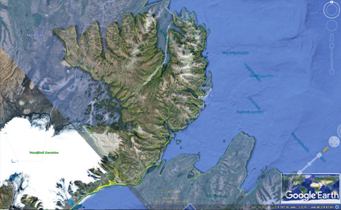
To realize better what has happened, let us look at the two areas separately:
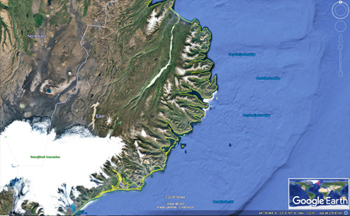
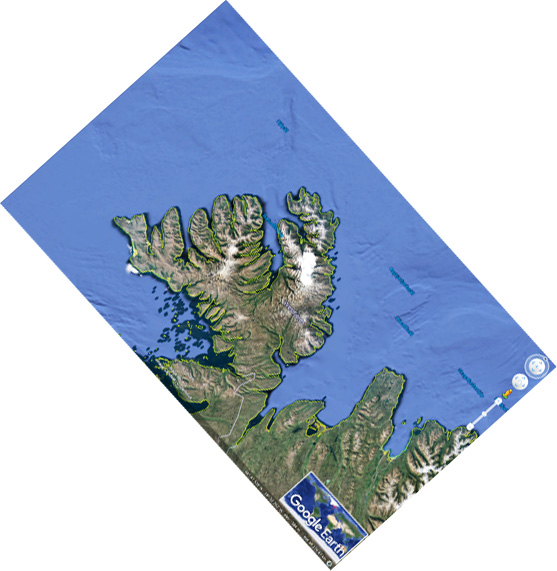
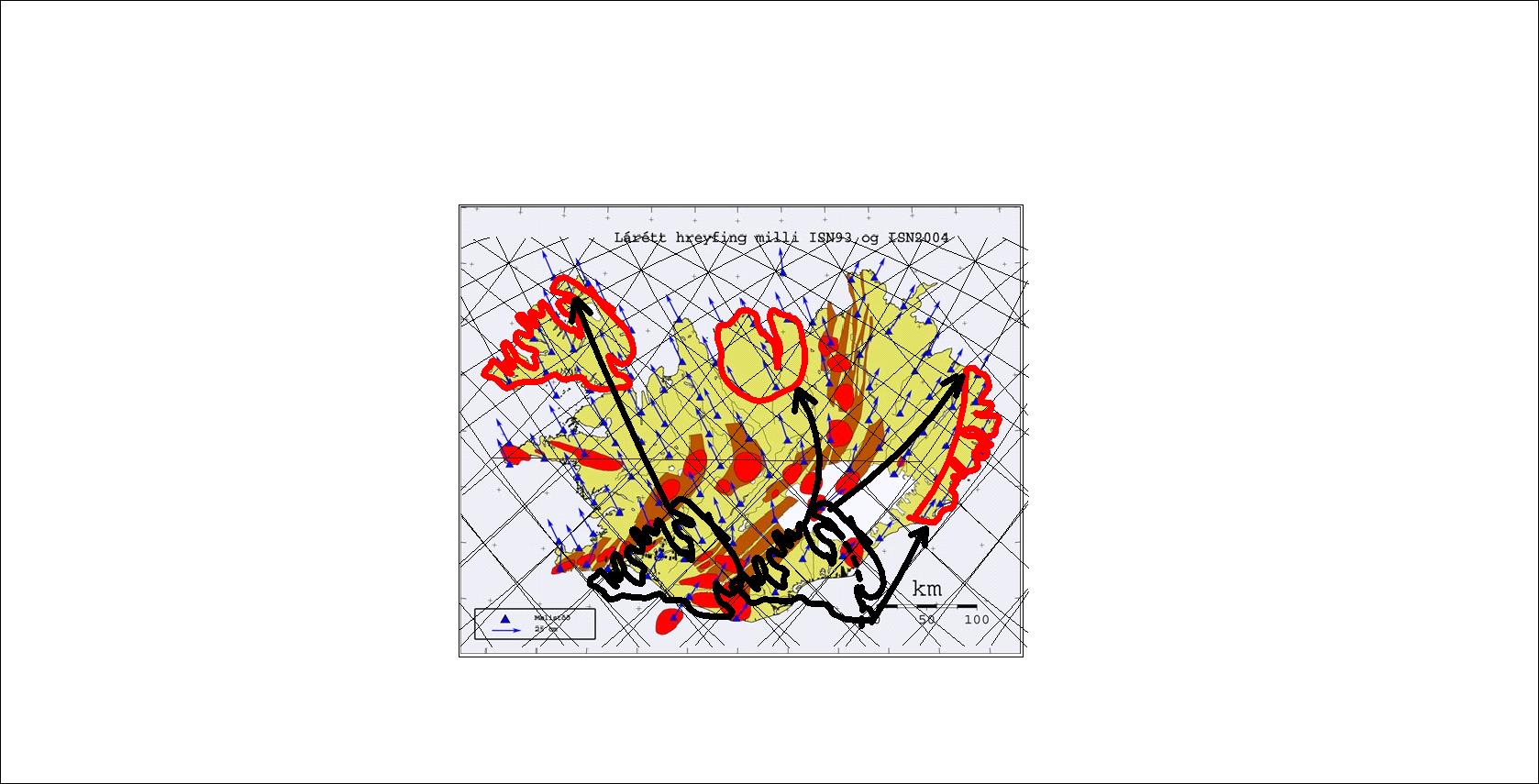
The overlapping is as perfect as possible, compared to having been subject to different circumstances for millions of years. No one would think of comparing these coastlines, unless first tracing the lines of tectonic drift. We can simply ‘play back’ the whole process according to GPS measurements of tectonic drift by tracing the vectors:
In addition, the Eyjafjörður and Tröllaskagi area can be compared with the West Fjord Peninsula, as by rotating Ísafjörður 24°.
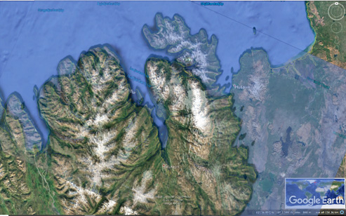
The consistency is not only found to be intriguing becuse it ‘fits’ well, but because the rotation is half of that between the Strandir region and the East Fjord area. It is interesting to see how the Hornstrandir version of the peninsula east of Eyjafjörður has been removed by the Húsavík Fault System. It can also be seen that Arnarfjörður is narrower than Skagafjörður. It can be explained by the fact that for about a million years Skagafjörður was a volcanic zone taking part in the tectonic drift. Arnarfjörður is 6 km wide, compared with 16 km of Skagafjörður, which means that the widening of Skagafjörður during that period of time was close to 1 cm each year.
Comparison between these areas with basic explanations:
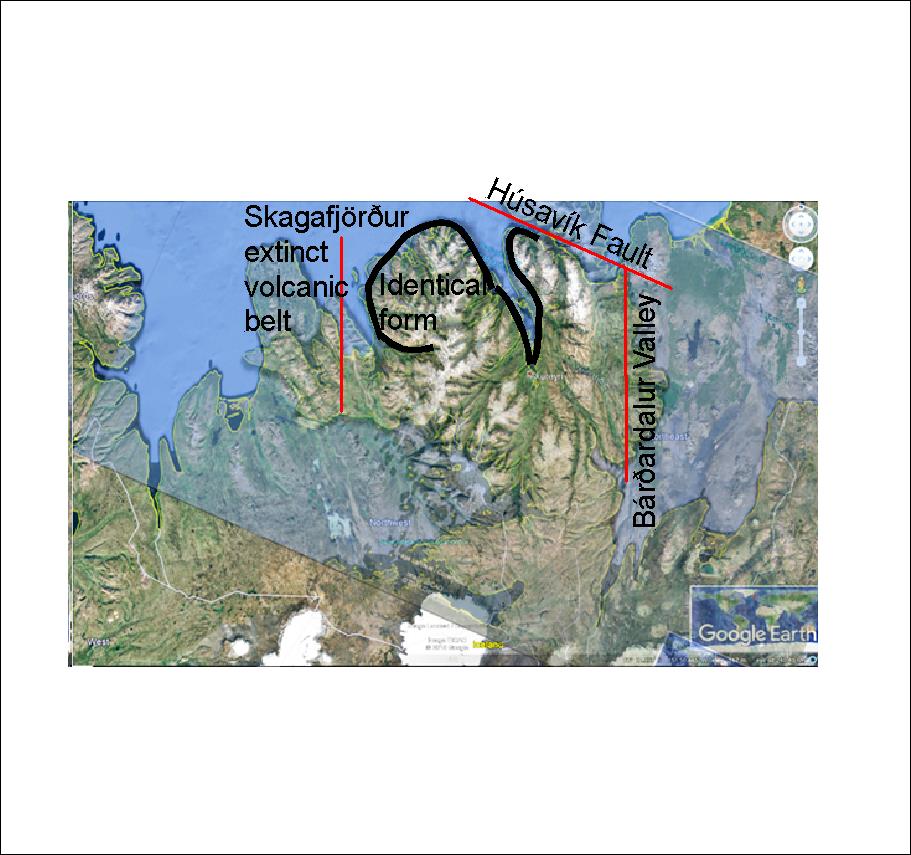
Adding the West Fjord Peninsula almost disappears into the North of Iceland, and the Tröllaskagi Peninsula has a very similar system of valleys as the Peninsula. Every detail and every piece of geological knowledge does add to the understanding of these geologically related areas.
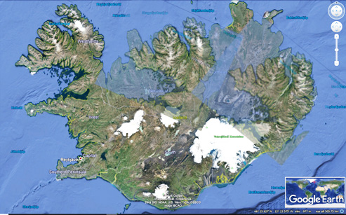
This seems amazing, but how is all this duplicated? As usually it has to be traced with a lot of work. Look for instance at Lagarfljót, and how it resembles Ísafjörður and Eyjafjörður! Crazy!