The SE edge of Vatnajökull is lineray oriented to the NE from Öræfajökull Volcano. This edge is formed by a line of mountains, which ar found above the easternmost up-welling mantle division lines crossing the country in that direction. Geothermal heat is found in the valleys, and the more the glacier retreats, the more has been found.
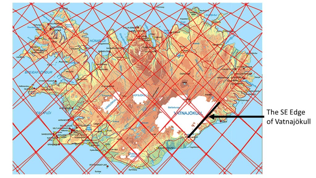
The calculated division line coincides with the mountains forming the edge of the glacier. It has been found that the number of dikes is high in the area and geothermal activity quite appearent. This up-welling, along the upper most line of 120 km depth, and the third layer as well farther down (below 265 km) is also up-welling, and almost coincides with convection layer 1, adds to the effect.
Vatnajökull: https://www3.uef.fi/documents/640649/725289/NEED+V_New+Geo+Review.pdf/273c6abe-cf05-4c36-92cb-a5cc3fdaf930