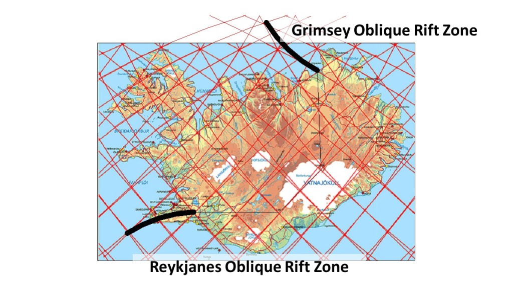
The Mid-Ocean Ridge north of Iceland is connected through the Grimsey Oblique Rift. Looking at the Google Map, with a convection rolls system map superimposed, the context becomes quite clear:
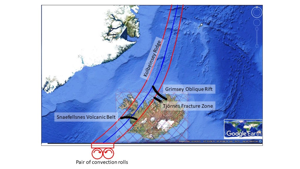
The pair of convection rolls extending north of Iceland follow the Kolbeinsey Ridge closely. The eastern convection roll also coincides with the northernmost part of Reykjanes Ridge. (The main part of the Reykjanes Ridge is then shaped by the convection rolls system extending from equator.) A certain aspect of the Tjörnes Fracture Zone is revealed here, namely that it connects the North Volcanic Zone divisional effect with the upwelling division line found north of Eyjafjordur. On the other hand, the Grimsey Oblique Rift extends to the downwelling line found at the eastern side of Kolbeinsey Ridge. This also reveals a certain difference between Kolbeinsey Ridge and the Reykjanes Ridge. Kolbeinsey Ridge resembles a volcanic zone in a way, because it follows a path in between two division lines of the convection rolls. The convection roll is thereby coupled to the tectonic plate, providing resistance to the main tectonic drift of the North American Tectonic Plate in the opposite direction. The Snaefellsnes Volcanic Belt extends over the two convection rolls, thereby also playing a role in the adjustments related to the Kolbeinsey Ridge.
The Kolbeinsey Ridge did break the Jan Mayen Microcontinent away from Eastern Greenland, and the northern end of the ridge is at the so-called Jan Mayen Fracture Zone, as can easily be detected on the map. That does not affect the convection rolls, as they are formed out of slowly flowing mantle material. The properties of convection rolls are quite special, as the mantle there is not molten, but not rigid either. The physical properties are balanced and quite stable, leading to a regular geological arrangement on the surface as well.