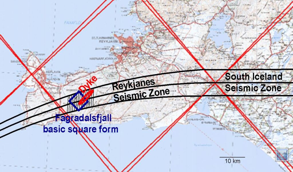
The formation of a dyke near the town of Grindavik in Iceland was quite sudden. First, a sill did form at the depth of approximately 5 km. Then magma started to make its way upwards, forming a dyke reminding us of what has happened in the vicinity of Fagradalsfjall three times during the last three years.
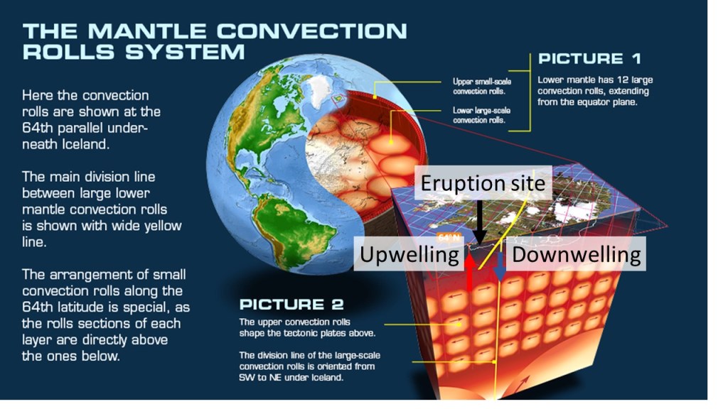
The dyke can be compared to the convection rolls model, and two lines cross the center of the dyke. The lines are blue, standing for down-welling. Down-welling can provide magma just as up-welling. The southern part of the dyke is aligned parallel to the convection rolls pattern, but the northern half is more affected by the earthquake zone, where NS oriented earthquake faults are a dominant factor within the brittle part of the crust.
The inserted maps are from ISOR (for volcanic systems) and the Icelandic Met Office (dyke formation indicated by earthquake epicenters). The main drawing is superimposed on a map from the National Land Survey. The main divison line is based on present tectonic drift vectors.

A section of the layers, represented by red and blue lines, is shown here below. This was prepared to show the location of the Fagradalsfjall eruptions, but they were so close to the site of the formation of the dyke presently ascending, so it is also used here as a representation: