Geodetic measurements show that plate separation across Iceland is directed approximately N15°E (equivalent to ~105° azimuth). This regional extension is commonly illustrated on geological maps by symmetrical vectors on either side of the island.
Yet the structural grain of the East Volcanic Zone at ~64°N trends N42°E, implying a misalignment of about 27° relative to the plate motion vector.
In classical fracture mechanics, extension should generate rifts perpendicular to the direction of maximum tensile stress. The observed geometry in Iceland therefore indicates that additional controls modify the stress field within the crust.
One plausible mechanism is the influence of organized **mantle convection patterns. If the upper mantle is structured into long, coherent convection rolls, their boundaries may impose a polygonal framework on the lithosphere. These boundaries can act as zones of mechanical weakness, guiding the localization and اتجاه of rifting.
In this framework, the regional plate-separation vector (N15°E) is not directly expressed at the surface. Instead, extension is effectively reprojected along the geometry of convection-driven domains, producing rift segments such as the East Volcanic Zone with an orientation of N42°E.
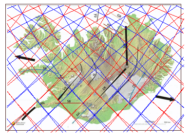
A map published by Iceland GeoSurvey, showing inferred convection-roll division lines, highlights this systematic angular discrepancy.