There are many ways in which Iceland can be meaningfully compared with the convection-rolls model of mantle flow. When viewed from a holistic, bird’s-eye perspective, the combined pattern of the continental shelf, mid-ocean ridges, and the alignment of Iceland’s stratovolcanoes begins to tell a coherent geological story.

To make full sense of this, however, it is essential to understand both the location and the function of the major convection rolls situated beneath Iceland.

Once the geometry of these convection rolls is recognized, the division lines between them clearly mark the boundary limits of Iceland’s volcanic zones.

Numerous specific details illustrate this correspondence—for example, the distribution of Iceland’s primary geothermal areas aligns closely with the convection roll that extends from the Reykjanes Ridge beneath the island.

With this convection-roll framework in place, further analysis becomes possible, such as subdividing the volcanic zones into their natural segments and comparing the intensity and style of activity within each one.


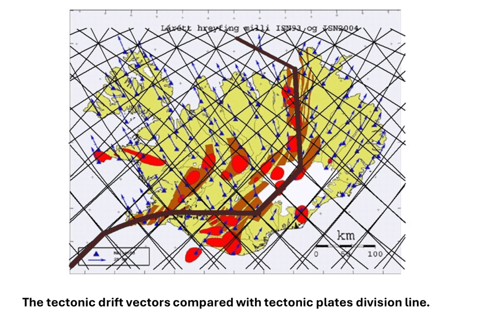
The tectonic drift vectors across Iceland can also be compared directly with the grid formed by the convection-roll boundaries. This allows an accurate, physically meaningful line to be drawn representing the division between the North American and Eurasian plates.
In turn, Iceland’s smaller peripheral volcanic zones can be examined in this context.

These zones tend to occupy the regions between the edges of adjacent convection-roll polygons. In fact, virtually every detail of Iceland’s tectonics, geothermal distribution, and volcanic structure can be actively compared—and consistently correlated—with this convection-roll system. This approach provides a unified model that connects deep-mantle dynamics with the observable geological features on the surface.
