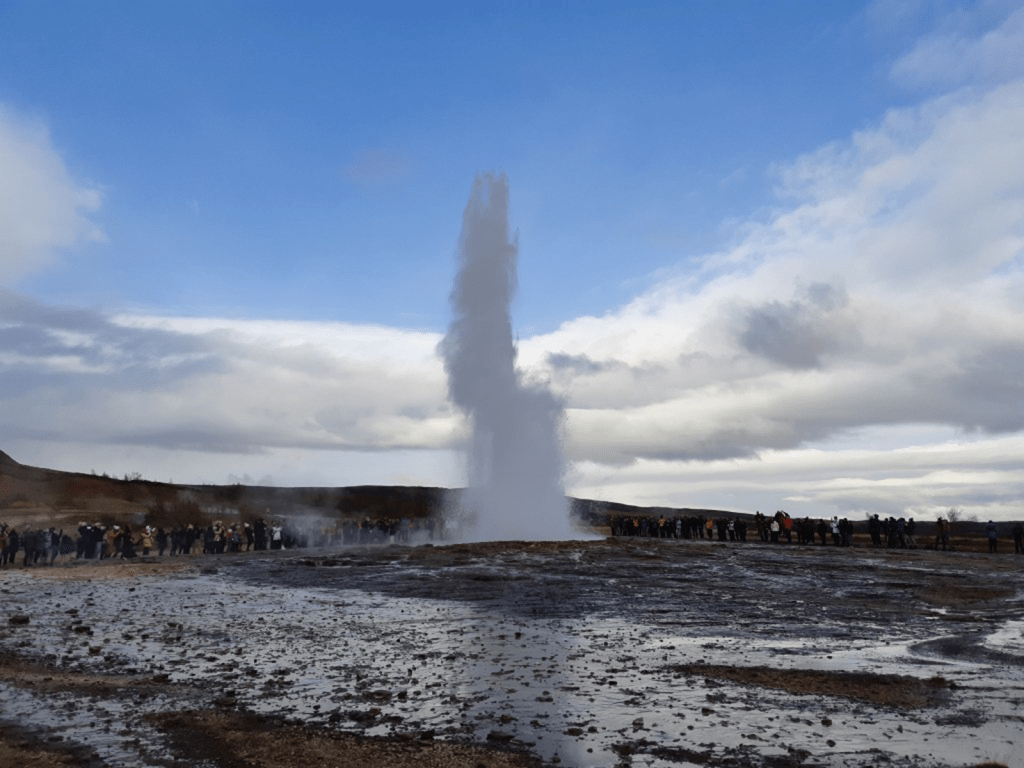
People stand there all day:
The location of the Icelandic Geysir is above the lower mantle division lines, as seen below:

Looking at the location in more detail:

A picture of the area can then be examined:
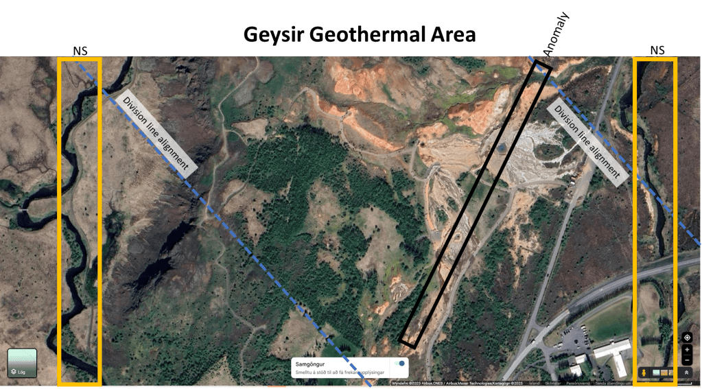
The Geysir geothermal area can be interpreted in a way that aligns naturally with the large-scale convection-roll model. The key is understanding how the regional structural geometry, the local fracture network, and the three-dimensional vapour reservoir interact. The area lies above two NW–SE-aligned division lines, which in the model represent boundaries between adjacent mantle-flow rolls. Such deep division lines tend to produce changes in the crustal stress field, zones of enhanced fracturing, and focused pathways for magmatic and hydrothermal fluids. It is therefore not surprising that the surface geothermal activity in Haukadalur is concentrated precisely where these boundaries intersect the crust.
These NW–SE structures meet and interfere with the dominant NE–SW trend of the West Volcanic Zone. The WVZ imposes the main tectonic and volcanic orientation in this part of Iceland, and when the two systems interact—one NE–SW, the other NW–SE—the result is a structurally complex zone with increased fracture permeability. Where these deep-rooted structural trends overlap, hydrothermal fluids can move more easily, leading to the clustering of geysers, steaming ground, and other geothermal features that characterise the Geysir field.
Recent geophysical imaging supports this interpretation by revealing that the vapour-dominated reservoir beneath the Geysir area stretches NW–SE. This alignment is significant: it matches the orientation of the proposed deep division lines and also cuts across the local anomaly long thought to reflect a fault or fracture connecting Geysir and Strokkur. Instead of a simple linear fault feeding the two geysers, the more plausible interpretation emerging from these observations is that the NW–SE vapour reservoir acts as the primary geothermal engine, while the Geysir–Strokkur line functions as a permeability pathway for warm water into this larger reservoir.
Viewed through the lens of the convection-roll model, the Geysir system becomes a clear example of how deep mantle-flow structures can influence surface geology. The NW–SE reservoir corresponds to a convection-roll division line, while the NE–SW orientation of the West Volcanic Zone reflects the regional upwelling limb of the roll, parallel to the main division lines, as shown on the maps. The interaction of these two trends produces the fracture architecture necessary to create one of Iceland’s most iconic geothermal systems. Rather than being controlled primarily by a local fault between Geysir and Strokkur, the system appears to be driven by the intersection of broader structural patterns inherited from deep mantle dynamics.
More about the vapour reservoir of the Geysir area:
Lupi, M., Collignon, M., Fischanger, F.,
Carrier, A., Trippanera, D., & Pioli, L.
(2022). Geysers, boiling groundwater
and tectonics: The 3D subsurface
resistive structure of the Haukadalur
hydrothermal field, Iceland. Journal
of Geophysical Research: Solid Earth,
127, e2022JB024040. https://doi.
org/10.1029/2022JB024040
