The San Andreas Fault and Yellowstone Caldera are shown on this map:
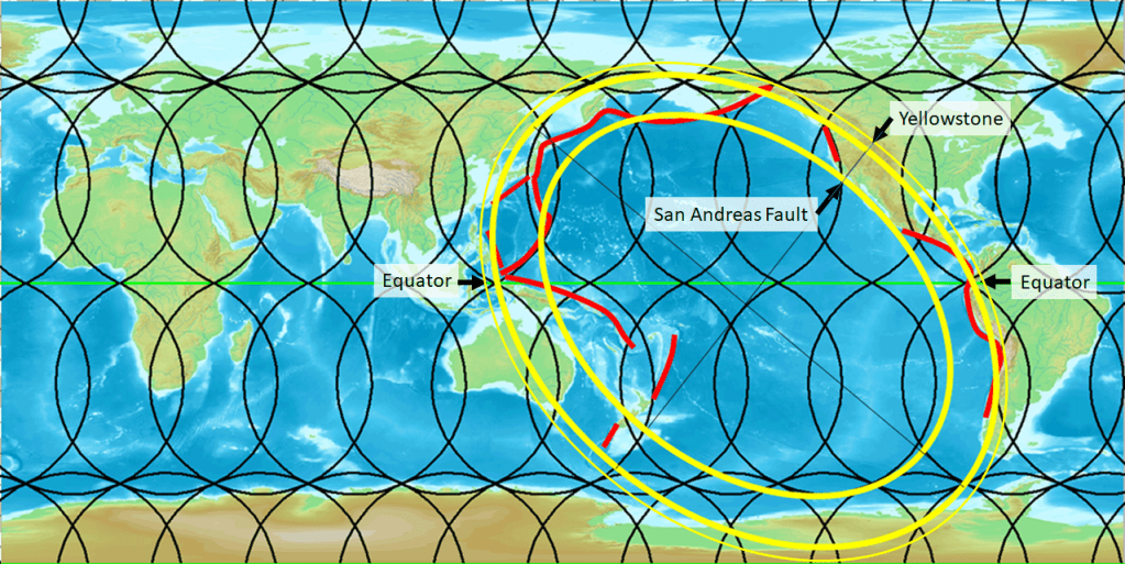
Those famous sites have a comparable position compared with the so-called Ring of Fire as drawn here. Most subduction zones around the Pacific fit into a tight elliptical form centered at 6°S and 155°E with eccentricity = 1.4. It passes equator at the coast of Indonesia and South America. This is drawn on an equirectangular map, used for the mantle convection rolls model. The major axis is tilted 40° and the minor 50°. The Central San Andreas Fault and Yellowstone are thereby found at the inner and outer limits of this mathematical version of the Ring of Fire. Those are probably the most famous geological features of the United States, along with the Grand Canyon. There are explanations available for this consistency, as shown here: https://pangea.stanford.edu/ERE/db/GeoConf/papers/SGW/2024/Thorbjarnarson.pdf
