The third eruption at Fagradalsfjall of the Reykjanes Peninsula in Iceland is now considered likely to occur, according the news. https://www.ruv.is/frettir/innlent/2023-07-05-ovissustigi-lyst-yfir-vegna-jardskjalftahrinu-gos-mogulegt-innan-farra-daga-386976.
The dyke feeding the eruptions is active again, causing earthquakes. Land has been rising considerably according to measurements as shown here: https://www.vedur.is/um-vi/frettir/landris-hefur-maelst-vid-fagradalsfjall-sidan-i-april.
Let us draw a theoretical map showing the basic geological framework of the area. The volcanic systems are not included, except for inidcating the location of the active dyke with red elliptical form. The Reykjanes Seismic Zone is shown theoretically, along with earthquake faults around Fagradalsfjall. The apparent shape of Fagradalsfjall is shown with a blue square.
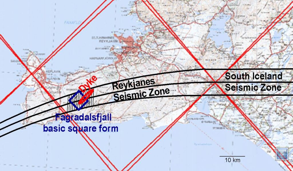
Having inserted these features, it appears that Fagradalsfjall is formed by the interaction between the volcanic and seismic activity of the peninsula. It is predicted that an eventual eruption will occur at an intersection point between the dyke and an earthquake fault. The earthquake faults are oriented N-S, wheras the dyke is oriented NE-SW.
The South Iceland Seismic Zone and Reykjanes Seismic Zone are here shown as connected, according to the Convection Rolls Model.
