Comparing Iceland and Norway at the same latitudes 30° apart should lead to some analogy due to the same pattern of convection rolls. Here is an example.
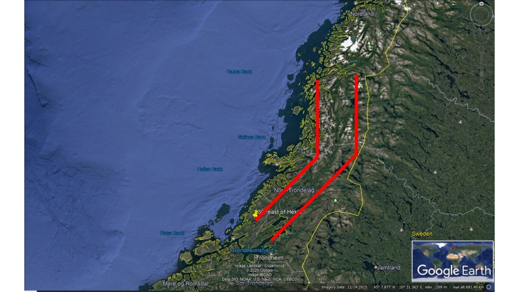
East and North Volcanic Zones of IcelandMap of Norway with markings 30° east of the East and North Volcanic Zones of Iceland
The similarity is quite striking. A NS-structure is found accurately 30° east of the North Volcanic Zone of Iceland, which is aligned exactly NS. The bending structure connecting with the NE-SW oriented East Volcanic Zone of Iceland is found exactly at the same latitude in Norway. In addition, the points 30° apart, of Hekla in Iceland and in the Trondheim area in Norway, are aligned exactly in the same way.
I am a geologist, graduated from the University of Iceland, and taught geology for a few years. I have gained some knowledge about Earth's inner structure, so I provide this website as my contribution to answer one of the greatest questions remaining within the realm of geoscience. Experiments show that the mantle should form convection rolls when close to the melting point. I took this literally, and calculated the dimensions and shape of these mantle convection rolls. Then I compare that model with the surface. This makes it possible to provide many interesting examples about geology found on my blog.
View all posts by Steingrimur Thorbjarnarson