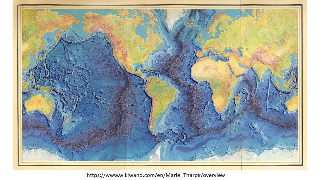
The mid ocean ridges can be compared with the convection rolls system. The original map looks like that:
The Mid Ocean Ridges mapped by Tharp and Heezen
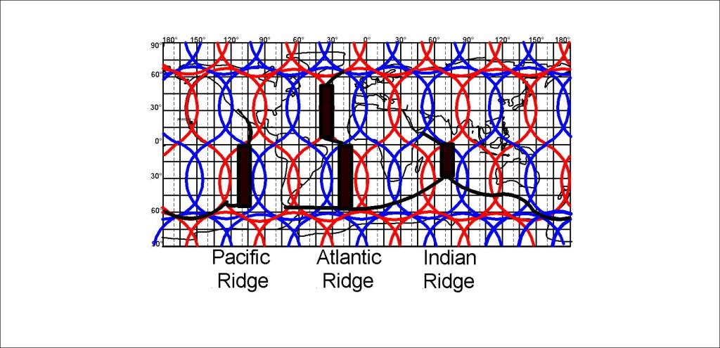
This can be compared with the convection rolls in a simple way:
Simplified Pattern of Mid Ocean Ridges
A more precise analysis, down to the 1.5° accuracy level, reveals much more, as shown for instance for the Reykjanes Ridge, barely noticeable on this World Map. The Reykjanes Ridge follows a division line exactly.
A profound difference is found between the North Atlantic Ridge and the South Atlantic Ridge. The North Atlantic Ridge is found along a up-welling line, but the South Atlantic Ridge is found in between the lines. A pattern of three ridges, for the Pacific, S-Atlantic and Indian Ocean, in harmony with the 30° divisions between convection rolls, appears,
I am a geologist, graduated from the University of Iceland, and taught geology for a few years. I have gained some knowledge about Earth's inner structure, so I provide this website as my contribution to answer one of the greatest questions remaining within the realm of geoscience. Experiments show that the mantle should form convection rolls when close to the melting point. I took this literally, and calculated the dimensions and shape of these mantle convection rolls. Then I compare that model with the surface. This makes it possible to provide many interesting examples about geology found on my blog.
View all posts by Steingrimur Thorbjarnarson