The two plates of N-America and Eurasia are divided in four ways at the NE-corner of Iceland. The Tjörnes Fracture Zone is by no means simple, but it has been studied quite thoroughly.
The triple fault system follows closely convection rolls found at around 400 km depth:
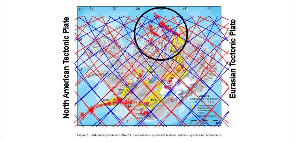
Basic map from the article Plate boundaries, rifts and transforms in Iceland by Páll Einarsson in Jökull 2008.
The resemblance is striking, but here we tend to forget the volcanic component. The general idea can be derived from this map from Wikipedia, where the most relevant convection roll has been pointed out by thickening the outlines of upwelling and downwelling:
A detailed analysis according to tectonic studies, where the effect of different convection rolls layer is taken into account, would make us understand more clearly how the faults are aligned according to the polygons and division lines.
I am a geologist, graduated from the University of Iceland, and taught geology for a few years. I have gained some knowledge about Earth's inner structure, so I provide this website as my contribution to answer one of the greatest questions remaining within the realm of geoscience. Experiments show that the mantle should form convection rolls when close to the melting point. I took this literally, and calculated the dimensions and shape of these mantle convection rolls. Then I compare that model with the surface. This makes it possible to provide many interesting examples about geology found on my blog.
View all posts by Steingrimur Thorbjarnarson