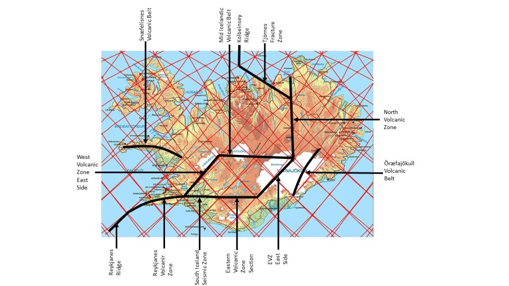
The grid of convection rolls explains the tectonic framework of Iceland:
Outlines of the Tectonic Framework of Iceland
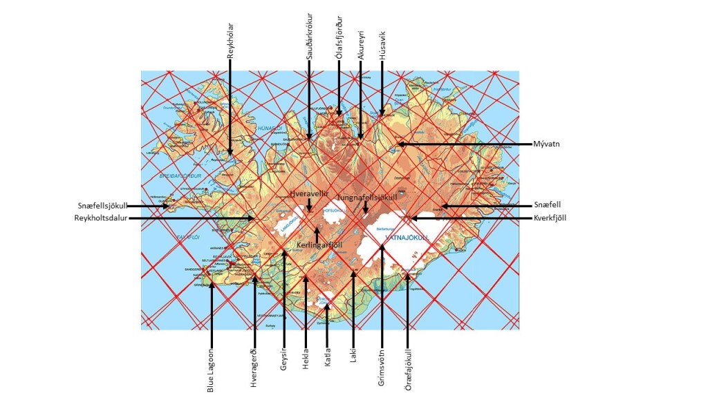
The same applies for main volcanic and geothermal sites:
Some Volcanic and Geothermal Sites in Iceland
The tectonic framework shows direct resemblance with the model of convection rolls found under the country. Likewise, many volcanic and geothermal sites are found in context with the crossings of division lines of different layers of mantle convection rolls.
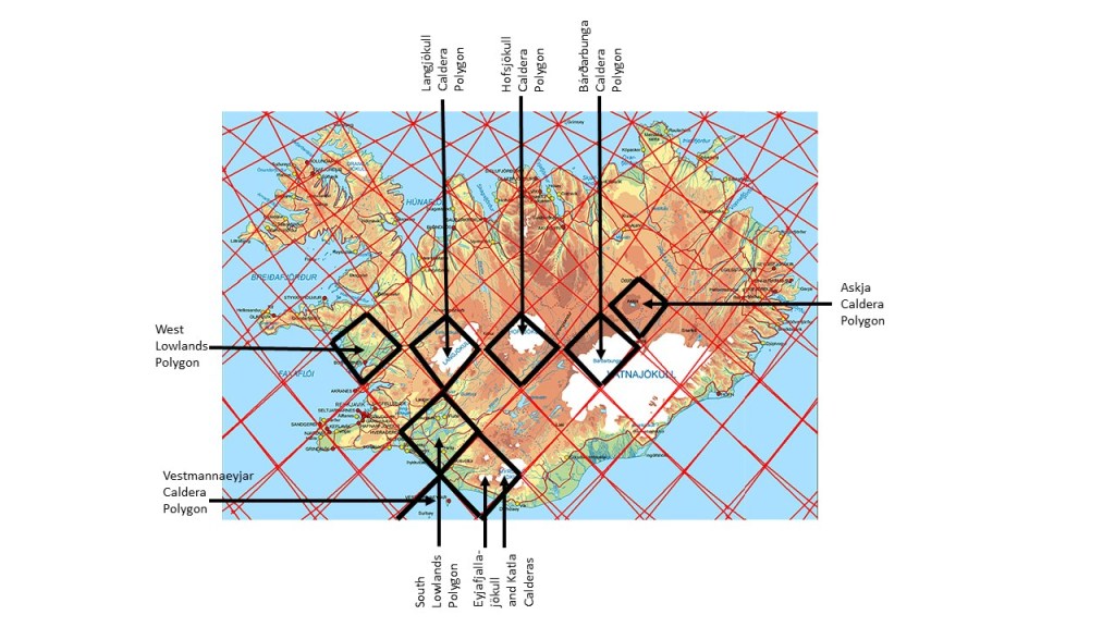
Besides this, we can look into the polygons of the network of division lines between convection rolls of different layers:
Polygons compared to distinct areas
The calderas along the central parts of Iceland have the function of providing magma for dikes to fill up the void created by tectonic drift.
I am a geologist, graduated from the University of Iceland, and taught geology for a few years. I have gained some knowledge about Earth's inner structure, so I provide this website as my contribution to answer one of the greatest questions remaining within the realm of geoscience. Experiments show that the mantle should form convection rolls when close to the melting point. I took this literally, and calculated the dimensions and shape of these mantle convection rolls. Then I compare that model with the surface. This makes it possible to provide many interesting examples about geology found on my blog.
View all posts by Steingrimur Thorbjarnarson