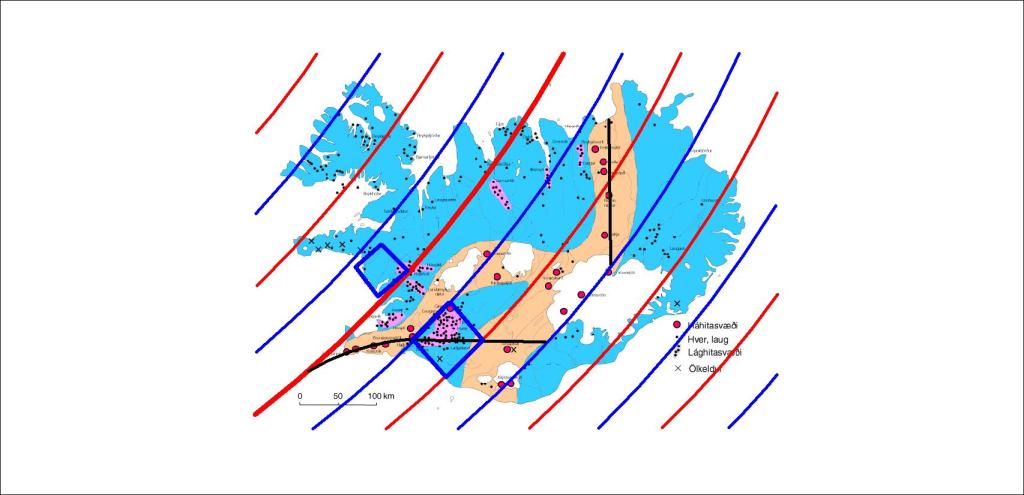
The two main lowland areas are marked on this map:
The two lowland areas of South and West
The outlines of the lowlands are obvioulsly marked by the convection rolls division lines.
The lowland areas compared with uppermost division lines
The Reykjanes Ridge uppermost division line does cross the geothermal area of the West, whereas the large geothermally active area of the South is found mainlu within a triangle, north of the South Iceland Seismic Zone (and within it), inside the polygon of the Southern Lowlands.
I am a geologist, graduated from the University of Iceland, and taught geology for a few years. I have gained some knowledge about Earth's inner structure, so I provide this website as my contribution to answer one of the greatest questions remaining within the realm of geoscience. Experiments show that the mantle should form convection rolls when close to the melting point. I took this literally, and calculated the dimensions and shape of these mantle convection rolls. Then I compare that model with the surface. This makes it possible to provide many interesting examples about geology found on my blog.
View all posts by Steingrimur Thorbjarnarson