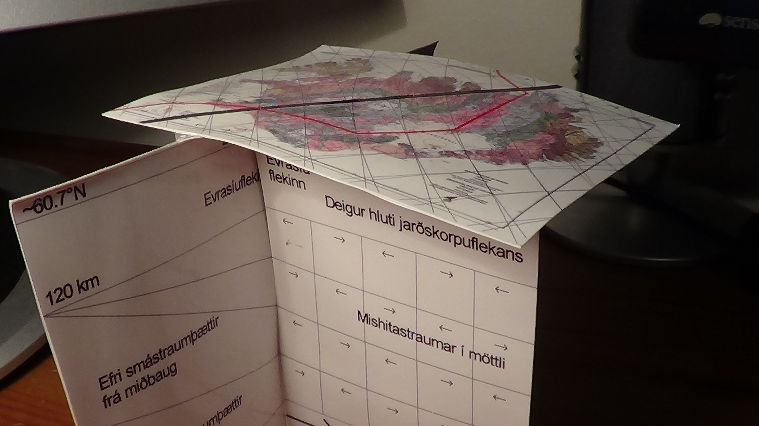
Looking at the foundations of Iceland at 64°N shows how the geology along the latitude is divided into distinct ‘chapters’.
Iceland with tectonic plate down to 120 km, then layers of convection rolls as they are organized along 64°N. The thickness within the intersection zone of individual layers is also shown.
The convection roll shown farthest to the left is at the main division line over the large convection cells of lower mantle. It is marked with bold black line over the country from SW to NE. With 3D models like this one it becomes possible to understand the pattern of convection rolls under the tectonic plates all over the world.
Of course, this can still not be understood by looking at this model. The picture is published here just to show that the model has been derived, and everyone interested in the subject can learn about it. This has hitherto been a huge gap in the knowledge spectrum of geoscience.
I am a geologist, graduated from the University of Iceland, and taught geology for a few years. I have gained some knowledge about Earth's inner structure, so I provide this website as my contribution to answer one of the greatest questions remaining within the realm of geoscience. Experiments show that the mantle should form convection rolls when close to the melting point. I took this literally, and calculated the dimensions and shape of these mantle convection rolls. Then I compare that model with the surface. This makes it possible to provide many interesting examples about geology found on my blog.
View all posts by Steingrimur Thorbjarnarson