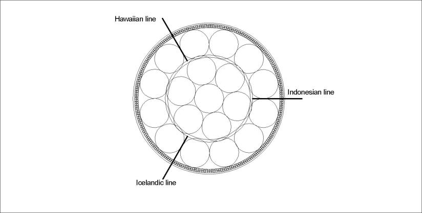
It becomes easy to comprehend the activity of Iceland, Hawaii and Indonesia when looking at the convection cells pattern. The 2D sketch of equator plane is:
And the relevant world map of the same lines is then:
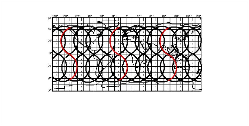
Where the lines for Iceland, Hawaii and Indonesia are marked red.
All this can be derived from one simple precondition: Stability conditions of the mantle.
Once understanding what this means, calculations can replace compiling data in many cases, saving effort and money on a grand scale.
Published by Steingrimur Thorbjarnarson
I am a geologist, graduated from the University of Iceland, and taught geology for a few years. I have gained some knowledge about Earth's inner structure, so I provide this website as my contribution to answer one of the greatest questions remaining within the realm of geoscience. Experiments show that the mantle should form convection rolls when close to the melting point. I took this literally, and calculated the dimensions and shape of these mantle convection rolls. Then I compare that model with the surface. This makes it possible to provide many interesting examples about geology found on my blog.
View all posts by Steingrimur Thorbjarnarson
